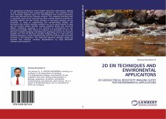
2D Eri techniques and environmental applications
2D geoelectrical resistivity imaging study for environmental applications
Versandkostenfrei!
Versandfertig in 6-10 Tagen
39,99 €
inkl. MwSt.

PAYBACK Punkte
20 °P sammeln!
The geophysical techniques reveal reliable subsurface information relating to civil, environmental and engineering applications. The resistivity of the rock formation depends upon the mineralogical and textural properties and is also affected by the moisture content. The resistivity technique that is commonly used can be operated by either vertical electrical sounding or profiling method and the vertical changes or horizontal changes can be recorded. In many of engineering and environmental studies, the horizontal and vertical resistivity variations are to be synchronized to map any sub surfac...
The geophysical techniques reveal reliable subsurface information relating to civil, environmental and engineering applications. The resistivity of the rock formation depends upon the mineralogical and textural properties and is also affected by the moisture content. The resistivity technique that is commonly used can be operated by either vertical electrical sounding or profiling method and the vertical changes or horizontal changes can be recorded. In many of engineering and environmental studies, the horizontal and vertical resistivity variations are to be synchronized to map any sub surface bodies, boulder cavities, pollution plume and structural details. Traditional sounding is not sufficient to comprehend to the required knowledge. With advent of computer, the illustration of 2D or 3D electrical resistivity imaging resembling the geological section has become feasible one. The 2D electrical resistivity imaging study is a fast and cost effective technique, which simultaneously scans the vertical and horizontal horizons in the subsurface. The measured apparent resistivity values are inverted into inversion resistivity pseudosection by using RES2DINV software and iterated to


