22,99 €
inkl. MwSt.

Versandfertig in 6-10 Tagen
payback
11 °P sammeln
  • Broschiertes Buch

The paper is dedicated to the development of the methodology of creating of three-dimensional cartographic image with the usage of modern information technologies. The review of the modern state of 3D mapping and the analysis of artistic and cartographic images, which have been created from the sixteenth century to the present time, are represented. The theoretical foundations of three-dimensional mapping as well as the technical devices and software of processes of computer-aided creation of 3D map image are considered. The methodology and technology of creating of three-dimensional maps on…mehr

Produktbeschreibung
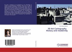
The paper is dedicated to the development of the methodology of creating of three-dimensional cartographic image with the usage of modern information technologies. The review of the modern state of 3D mapping and the analysis of artistic and cartographic images, which have been created from the sixteenth century to the present time, are represented. The theoretical foundations of three-dimensional mapping as well as the technical devices and software of processes of computer-aided creation of 3D map image are considered. The methodology and technology of creating of three-dimensional maps on the example of Palace and park complex in Nesvizh (Belarus) using computer technologies as well as the main aspects of updating of such maps are developed. The author also notes the prospects of development and improvement of technology in 3D cartography.
Autorenporträt
Master of geographical sciences, the teacher of the Department of geodesy and cartography of the Belarusian State University (Belarus). Research interests: the usage of modern computer technologies in cartography, the three-dimensional modeling, mapping of monuments of historical and cultural heritage, computer design, tourism.