3D Augmented Reality Mobile Application Prototype for Visual Planning Support
-
- Englisch ausgewählt
43,99 €
UVP
49,00 €
inkl. gesetzl. MwSt.,
Lieferung nach Hause
Beschreibung
Produktdetails
Einband
Taschenbuch
Erscheinungsdatum
11.04.2012
Verlag
LAP LAMBERT Academic PublishingSeitenzahl
76
Maße (L/B/H)
22/15/0,6 cm
Gewicht
131 g
Auflage
1. Auflage
Sprache
Englisch
ISBN
978-3-8484-4371-0
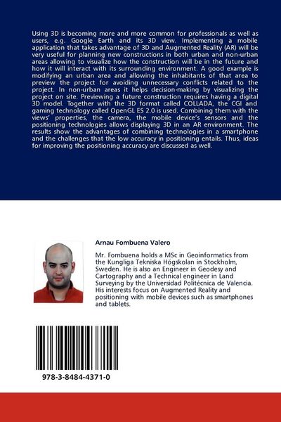
Using 3D is becoming more and more common for professionals as well as users, e.g. Google Earth and its 3D view. Implementing a mobile application that takes advantage of 3D and Augmented Reality (AR) will be very useful for planning new constructions in both urban and non-urban areas allowing to visualize how the construction will be in the future and how it will interact with its surrounding environment. A good example is modifying an urban area and allowing the inhabitants of that area to preview the project for avoiding unnecessary conflicts related to the project. In non-urban areas it helps decision-making by visualizing the project on site. Previewing a future construction requires having a digital 3D model. Together with the 3D format called COLLADA, the CGI and gaming technology called OpenGL ES 2.0 is used. Combining them with the views' properties, the camera, the mobile device's sensors and the positioning technologies allows displaying 3D in an AR environment. The results show the advantages of combining technologies in a smartphone and the challenges that the low accuracy in positioning entails. Thus, ideas for improving the positioning accuracy are discussed as well.
Kundinnen und Kunden meinen
Verfassen Sie die erste Bewertung zu diesem Artikel
Helfen Sie anderen Kund*innen durch Ihre Meinung
Kurze Frage zu unserer Seite
Vielen Dank für dein Feedback
Wir nutzen dein Feedback, um unsere Produktseiten zu verbessern. Bitte habe Verständnis, dass wir dir keine Rückmeldung geben können. Falls du Kontakt mit uns aufnehmen möchtest, kannst du dich aber gerne an unseren Kund*innenservice wenden.
zum Kundenservice