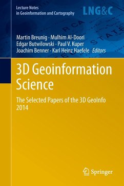
The Selected Papers of the 3D GeoInfo 2014 Herausgegeben:Breunig, Martin; Al-Doori, Mulhim; Butwilowski, Edgar; Kuper, Paul Vincent; Benner, Joachim; Haefele, Karl Heinz
Nowadays 3D Geoinformation is needed for many planning and analysis tasks. For example, 3D city and infrastructure models are paving the way for complex environmental and noise analyzes. 3D geological sub-surface models are needed for reservoir exploration in the oil-, gas-, and geothermal industry. Thus 3D Geoinformation brings together researchers and practitioners from different fields such as the geo-sciences, civil engineering, 3D city modeling, 3D geological and geophysical modeling, and, last but not least, computer science. The diverse challenges of 3D Geoinformation Science concern…mehr
Nowadays 3D Geoinformation is needed for many planning and analysis tasks. For example, 3D city and infrastructure models are paving the way for complex environmental and noise analyzes. 3D geological sub-surface models are needed for reservoir exploration in the oil-, gas-, and geothermal industry. Thus 3D Geoinformation brings together researchers and practitioners from different fields such as the geo-sciences, civil engineering, 3D city modeling, 3D geological and geophysical modeling, and, last but not least, computer science. The diverse challenges of 3D Geoinformation Science concern new approaches and the development of standards for above- and under-ground 3D modeling, efficient 3D data management, visualization and analysis. Finally, the integration of different 3D approaches and data models is seen as one of the most important challenges to be solved.
Artikelnr. des Verlages: 86374611, 978-3-319-12180-2
2015
Seitenzahl: 264
Erscheinungstermin: 10. Dezember 2014
Englisch
Abmessung: 241mm x 160mm x 20mm
Gewicht: 538g
ISBN-13: 9783319121802
ISBN-10: 3319121804
Artikelnr.: 41431057
Inhaltsangabe
Improving the Consistency of Multi-LOD Citygml Datasets by Removing Redundancy.- Generalization of 3D IFC Building Models.- Modeling and Managing Topology for 3-D Track Planning Applications.- Multi-Resolution Models: Recent Progress in Coupling 3D Geometry to Environmental Numerical Simulation.- Crisp Clustering Algorithm for 3D Geospatial Vector Data Quantization.- A Hybrid Approach Integrating 3d City Models, Remotely Sensed Sar Data And Interval-Valued Fuzzy Soft Set Based Decision Making for Post Disaster Mapping of Urban Areas.- Change Detection in Citygml Documents.- Change Detection of Cities.- Advances in Structural Monitoring by an Integrated Analysis of Sensor Measurements and 3d Building Model.- Requirements on Building Models Enabling The Guidance In A Navigation Scenario Using Cognitive Concepts.- Context Aware Indoor Route Planning using Semantic 3d Building Models with Cloud Computing.- Exploring the Benefits of 3D city Models in the Field of Urban Particles Distribution Modelling - a Comparison of Model Results.- 3d Modelling with National Coverage: Bridging the Gap between Research and Practice.- Out-of-core Visualization of Classified 3D Point Clouds.-Modeling Visibility in 3d Space: A Qualitative Frame of Reference.
Improving the Consistency of Multi-LOD Citygml Datasets by Removing Redundancy.- Generalization of 3D IFC Building Models.- Modeling and Managing Topology for 3-D Track Planning Applications.- Multi-Resolution Models: Recent Progress in Coupling 3D Geometry to Environmental Numerical Simulation.- Crisp Clustering Algorithm for 3D Geospatial Vector Data Quantization.- A Hybrid Approach Integrating 3d City Models, Remotely Sensed Sar Data And Interval-Valued Fuzzy Soft Set Based Decision Making for Post Disaster Mapping of Urban Areas.- Change Detection in Citygml Documents.- Change Detection of Cities.- Advances in Structural Monitoring by an Integrated Analysis of Sensor Measurements and 3d Building Model.- Requirements on Building Models Enabling The Guidance In A Navigation Scenario Using Cognitive Concepts.- Context Aware Indoor Route Planning using Semantic 3d Building Models with Cloud Computing.- Exploring the Benefits of 3D city Models in the Field of Urban Particles Distribution Modelling – a Comparison of Model Results.- 3d Modelling with National Coverage: Bridging the Gap between Research and Practice.- Out-of-core Visualization of Classified 3D Point Clouds.-Modeling Visibility in 3d Space: A Qualitative Frame of Reference.
Rezensionen
"The book 3D Geoinformation Science - The Selected Papers of the 3D GeoInfo 2014 is a good summary of current activity in 3D geoinformation, particularly as it relates to infrastructure and buildings. The collection of presentations in this book are focused on visualization within 3D concepts and the creation of 3D physical structures. ... For this reason readers will find this book highly informative, interesting and a good reference for understanding 3D Geoinformation." (Jeff Thurston, 3D Visualization World Magazine, March, 2015)
Es gelten unsere Allgemeinen Geschäftsbedingungen: www.buecher.de/agb
Impressum
www.buecher.de ist ein Internetauftritt der buecher.de internetstores GmbH
Geschäftsführung: Monica Sawhney | Roland Kölbl | Günter Hilger
Sitz der Gesellschaft: Batheyer Straße 115 - 117, 58099 Hagen
Postanschrift: Bürgermeister-Wegele-Str. 12, 86167 Augsburg
Amtsgericht Hagen HRB 13257
Steuernummer: 321/5800/1497