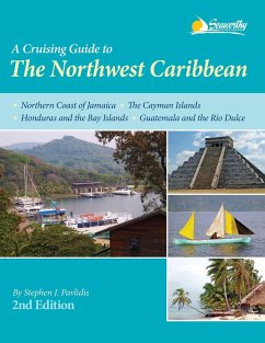
Cruising Guide to The Northwest Caribbean, 2nd ed details the waters of the Northern Coast of Jamaica, the Cayman Islands, Honduras and the Bay islands, and Guatemala including the Río Dulce. With full-color aerial harbor photos and 73 full-color sketch charts, it contains extremely accurate hydrographic data based on personally conducted independent surveys by the author. The Northwest Caribbean, 2nd ed also includes extensive navigational instructions, GPS waypoints, approaches and routes, anchorages, services, dive sites, history, basic information, extensive appendices, index, bibliography, and more for cruising in the Northwest Caribbean. Features: New Completely Updated Second Edition of this Pavlidis Guide! New Full-color Aerial Photos All Original Charts Based on Personal Surveys Conducted by the Author Extensive Navigational Instructions, and GPS Waypoints Coverage Area: Northern Coast of Jamaica The Cayman Islands Honduras and the Bay Islands Guatemala and the Río Dulce
Bitte wählen Sie Ihr Anliegen aus.
Rechnungen
Retourenschein anfordern
Bestellstatus
Storno

