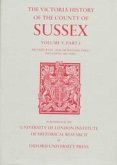
This volume contains the history of the town of Malmesbury and twenty surrounding parishes forming Malrnesbury hundred. The town evolved in the Anglo-Saxon period round the early monastic foundation: the town's position on a promontory between the Tetbury and Sherston branches of the Bristol Avon and the abbey's surviving buildings remain the town's most noticeable features. The abbey's estate included more than 20,000 acres in the twenty parishes, besidesmore outside the hundred. At the time of the Norman Conquest the town was as developed as any in Wiltshire, but after that it declined in comparison with neighbouring market towns, and its medieval street pattern, with the extension of the urban area into the adjoining parish of Westport, has persisted. In the surrounding parishes the abbey's lands were broken up at the Dissolution, but the Howards, earls of Suffolk and of Berkshire, built up a large estate centred on Charlton Park, the grandest mansion in the hundred. Among other large houses, Draycot House has been wholly destroyed, and Seagry House largely so. The rural parish churches include a fine example at Crudwell. The history of the landscape is traced in the inclosure of open arable fields from the 16th and 17th centuries; on the east the hundred adjoins Braydon forest, and the inclosure of the forest and its purlieus in the 1630s was also influential physically, socially, and economically. In the 20th century the area has been much affected by the building of the M4 motorway. One of the parishes which the road touches is Stanton St. Quintin, which might serve as a paradigm for the area, with its two villages (one with the church, manor house, rectory house, and school, the other with copyhold farmsteads and a nonconformist chapel), its manorial descent recorded without a break, its open fields and common pastures of which the location and dates of inclosure are known, its ancient woodland, possible lost village, hermitage, moated site, walled park, 20th-century housing, airfield, and motorway junction.
Hinweis: Dieser Artikel kann nur an eine deutsche Lieferadresse ausgeliefert werden.
Hinweis: Dieser Artikel kann nur an eine deutsche Lieferadresse ausgeliefert werden.


