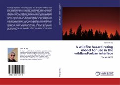
A wildfire hazard rating model for use in the wildland/urban interface
The WHINFOE
Versandkostenfrei!
Versandfertig in 6-10 Tagen
52,99 €
inkl. MwSt.

PAYBACK Punkte
26 °P sammeln!
As people move away from urban centers into the rural or wildland fringe surrounding developed urban and suburban centers, they are constructing large residential structures in amongst the flammable wildland vegetation. This intermixing of structural fuels with wildland vegetation fuels creates a significant wildfire management problem. Wildland fuels are partially dependent upon fire as a part of their environment. Human development structures are not compatible with a fire environment. This mixture of two different types of fuel with different tolerances for the presence of fire is the crux ...
As people move away from urban centers into the rural or wildland fringe surrounding developed urban and suburban centers, they are constructing large residential structures in amongst the flammable wildland vegetation. This intermixing of structural fuels with wildland vegetation fuels creates a significant wildfire management problem. Wildland fuels are partially dependent upon fire as a part of their environment. Human development structures are not compatible with a fire environment. This mixture of two different types of fuel with different tolerances for the presence of fire is the crux of the wildfire management problem in the Wildland/Urban Interface. An assessment model was developed that produces an integrated wildfire hazard rating metric based upon field gathered data and spatial data stored in a GIS. The hazard rating model is based upon a consensus of wildfire behavior/management experts as well as other codified fire science knowledge. In order to guide site mitigation, information beyond a single integrating metric is preserved so that users can determine the most significant factors contributing to the wildfire hazard for a site.


