Above New Orleans
Roofscapes of the Crescent City
Versandkostenfrei!
Versandfertig in über 4 Wochen
43,99 €
inkl. MwSt.

PAYBACK Punkte
22 °P sammeln!
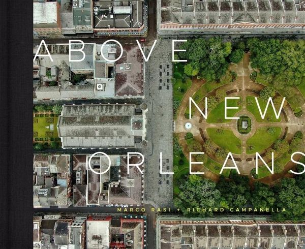
"Bird's eye views of New Orleans appeared first in the nineteenth century from the vantage point of hot-air balloons. In the twentieth-century, photographers in bi-planes, commercial aircraft, and helicopters trained their lenses on the Crescent City. While these methods of capturing the city from above offer fascinating glimpses of its neighborhoods, buildings, gardens, streets, and people, the images are broadly focused and necessarily taken from afar. Drone technology shattered those longtime limits, creating a whole new way of seeing New Orleans from overhead. In "Above New Orleans," geogr...
"Bird's eye views of New Orleans appeared first in the nineteenth century from the vantage point of hot-air balloons. In the twentieth-century, photographers in bi-planes, commercial aircraft, and helicopters trained their lenses on the Crescent City. While these methods of capturing the city from above offer fascinating glimpses of its neighborhoods, buildings, gardens, streets, and people, the images are broadly focused and necessarily taken from afar. Drone technology shattered those longtime limits, creating a whole new way of seeing New Orleans from overhead. In "Above New Orleans," geographer Richard Campanella deftly describes the astounding images of the city captured by drone-mounted cameras by professional drone pilot Marco Rasi. Organized without sections, images in the volume are free-flowing, starting in the urban core and, bird-like, spiraling outwardly to the metropolitan periphery. Opening scenes focus on the original city of New Orleans, today's French Quarter, after which we proceed downriver to the neighborhoods of the Faubourg Marigny, Bywater, the Upper Ninth Ward, Faubourg Tremâe and St. Roch, and the Lower Ninth Ward. We then soar back to downtown and explore the Central Business District, Lower Garden District, Central City, and Mid-City to City Park, the Esplanade Ridge, and the cemeteries along the Metairie Ridge. From there we head into the Garden District and fly uptown, along St. Charles Avenue to the Audubon/ University area through Carrollton, then across the river to the West Bank communities of Algiers, Greta, and Westwego, down to Lafitte at one point. Marco's drone then loops back along the Lake Pontchartrain shore and flies to eastern New Orleans and St. Bernard Parish, all the way out to the Rigolets, and returns just as far west, to Metairie and Kenner in Jefferson Parish and the Bonnet Carrâe Spillway in St. Charles Parish"--


