147,99 €
inkl. MwSt.
Versandkostenfrei*
Versandfertig in 6-10 Tagen
payback
74 °P sammeln
  • Gebundenes Buch

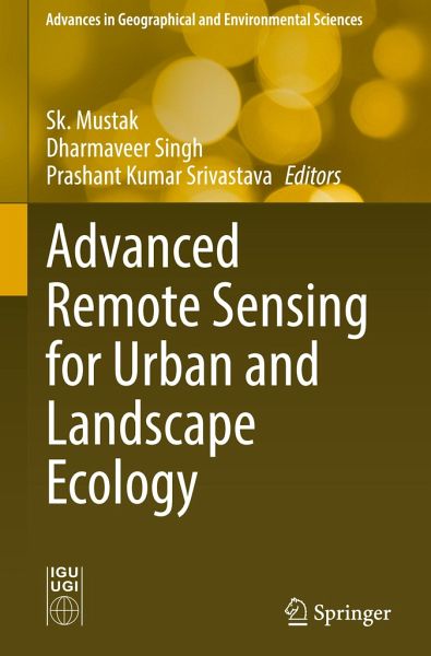
This book introduces the use of various remote sensing data such as microwave, hyperspectral and very high-resolution (VHR) satellite imagery; mapping techniques including pixel and object-based machine learning; and geostatistical modelling techniques including cellular automation, entropy and land fragmentation. Remote sensing plays a vital role in solving urban and environmental challenges at the landscape level. Globally, more than half of the urban population is facing severe environmental and social challenges, especially those relating to climate change, agricultural land encroachment,…mehr

Produktbeschreibung
This book introduces the use of various remote sensing data such as microwave, hyperspectral and very high-resolution (VHR) satellite imagery; mapping techniques including pixel and object-based machine learning; and geostatistical modelling techniques including cellular automation, entropy and land fragmentation. Remote sensing plays a vital role in solving urban and environmental challenges at the landscape level. Globally, more than half of the urban population is facing severe environmental and social challenges, especially those relating to climate change, agricultural land encroachment, green infrastructure and environmental degradation, mobility due to rapid rural-urban transformation and anthropogenic interventions. Mapping and quantification of such threats at the landscape level are challenging for experts using traditional techniques; however, remote sensing technology provides diverse spatial data at a varying scale, volume and accessibility for mapping and modelling, and it also analyses challenges at urban and landscape levels.

Together, they address challenges at urban and landscape levels to support the Sustainable Development Goals (SDGs).

Autorenporträt
Dr. Sk. Mustak is an assistant professor at the Department of Geography, the Central University of Punjab, Bathinda (India). His main research areas include applied earth observation, geoinformation and artificial intelligence in urban and regional planning, and landscape ecology. He served as a research associate and research coordinator at the Ecoinformatics lab, Ashoka Trust for Research in Ecology and the Environment (ATREE), Bangalore, during 2018-2020. Dr. Mustak completed his M.Sc. in geoinformation science and earth observation from the Faculty of Geo-Information Science and Earth Observation (ITC), the University of Twente, Netherlands, and his Ph.D. in urban geography with specialization in advanced remote sensing and artificial intelligence from Pt. Ravishankar Shukla University, Raipur, India. He was awarded an ITC fellowship, many other grants and international travel grants. He also received research grants from the Central University of Punjab, Bathinda, in 2020. He has presented 19 research papers at national and international conferences and published 15 research papers in national and international peer-reviewed journals, books and proceedings. He is a reviewer for several journals. Dr. Dharmaveer Singh is an assistant professor at the Symbiosis Institute of Geoinformatics, Symbiosis International (Deemed University), Pune, India. He was a research Scientist-C at the National Institute of Hydrology, Roorkee, India, from 2016 to 2018. Dr. Singh completed a Ph.D. in geoinformatics in 2015 at the Motilal Nehru National Institute of Technology, Allahabad. He received several academic awards, including the University Grants Commission (UGC) Early Career Research Grant in 2019, a post-doctoral fellowship from the Cold and Arid Regions Environmental and Engineering Research Institute, Chinese Academy of Sciences in 2016 and the Council of Scientific and Industrial Research-Junior Research Fellowship (National Eligibility Test) in 2009 and 2010.He held academic positions as a visiting scientist at the Institute of International Rivers and Eco-Security (IIRES), Yunnan University, in 2021-2022. His main research interests include water resources management, water security and economics, and climate change and modelling. He has published 30 research papers in peer-reviewed journals and conference proceedings. He is currently heading research projects sponsored by the UGC and is a reviewer for several scientific journals. Dr. Prashant Kumar Srivastava works at the Institute of Environment and Sustainable Development, Banaras Hindu University as a faculty member in remote sensing. He received his doctoral degree from the Department of Civil Engineering, University of Bristol, Bristol, UK. He received several awards such as the National Aeronautics and Space Administration (NASA) Fellowship, University of Maryland Fellowship, Commonwealth Fellowship and Early Career Research Award. He leads a number of projects funded by reputed agencies in India as well as abroad. He is also a collaborator with the NASA Jet Propulsion Laboratory on the Soil Moisture Active Passive (SMAP) mission as well as Scatterometer Satellite-1 (ScatSat-1), NASA-ISRO SAR Mission (NISAR) and Airborne Visible / Infrared Imaging Spectrometer (AVIRIS-NG) missions of India. He has published more than 180 peer-reviewed articles in journals and 9 books with renowned publishing houses such as Springer, Taylor and Francis, Wiley and Elsevier. He also serves as a regional editor of Geocarto International, an associate editor of Journal of Hydrology and more.