132,99 €
inkl. MwSt.
Versandkostenfrei*
Versandfertig in 6-10 Tagen
payback
66 °P sammeln
  • Gebundenes Buch

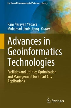
There are many GIS products for smart cities to implement smart city projects or activities. Most of the Geoinformatics Technologies and its application books are theoretical and lack of examples with real world data and step by step explanations to understand the facilities and utilities optimization and management for smart city applications and socio-economic aspects.
This book focuses and discusses topics related to how technological advances in Geoinformatics can help in the management operations of smart city applications to help our environment to be smart. Specifically, the volume
…mehr

Produktbeschreibung
There are many GIS products for smart cities to implement smart city projects or activities. Most of the Geoinformatics Technologies and its application books are theoretical and lack of examples with real world data and step by step explanations to understand the facilities and utilities optimization and management for smart city applications and socio-economic aspects.

This book focuses and discusses topics related to how technological advances in Geoinformatics can help in the management operations of smart city applications to help our environment to be smart. Specifically, the volume focuses on how these advancements can help optimize and manage facilities and utilities. This book focuses on geoinformation modelling, geo-smart city applications, geoinformation technology, information system and computer science, and geolocation and positioning as its five primary areas of discussion. Each of these primary subjects delves into the application that uses geoinformatics technology in greater depth. This covers the use of Geoinformatics technology in the prevention of crime, coastal erosion, carbon emission modelling, landslide modelling, urban farming, and various other applications linked to the field. This book's objective is to provide a comprehensive review of the accomplishments that geoinformatics has made in a number of different application areas for smart cities. It covers Geoinformation Technologies, Geoinformation Modelling, Information System and Computer Science, Geolocation & Positioning, and Geo-Smart City Applications.

The book will be useful to graduate students, university faculty, and researchers in Geoinformatics sciences/engineering and architecture and town planning. It will also be useful to entrepreneurs, professionals, and planners in policy and decision making at the local, state and national levels.

Autorenporträt
Prof. Ram Narayan Yadava holds the position of Advisor (Research & International Affairs) at Mansarovar Global University, Bhopal, (M.P.) India. He has worked as an advisor of the AISECT Group of Universities and a founding Vice Chancellor of the AISECT University, Hazaribag (Jharkhand), India. Prof. Yadava is also a foundingmember of a premier scientific research organization named Advanced Materials and Processes Research Institute (AMPRI) under the umbrella of the Council of Scientific and Industrial Research (CSIR), India. His research interests include Solid Mechanics, Environmental Quality and Water Resources, Hydrologic Modeling, Environmental Mldelling, and R&D Planning and Management. Dr.Yadava has executed a variety of research/consultancy projects in the areas of Water Resources Planning and Management, Environment, Remote Sensing, Mathematical Modeling, Technology Forecasting, etc. He has adequate experience in establishing institutes/organizations. In addition, he has adequate experience in planning, formulating, executing, and managing of R&D programs including organizing seminars/symposia/conferences at national and international levels. He has guided a number of M. Tech. and Ph.D. students in the area of Mathematical Sciences and Earth Sciences. Dr.Yadava has visited and delivered invited lectures at different institutes/universities in India as well as abroad in various countries such as the USA, Canada, UK, France, Thailand, Germany, South Korea, Malaysia, Singapore, South Africa, Costa Rica, The Netherlands, France, China, Tunisia and Australia. He is a Recipient of Raman Research Fellowship and other awards. Dr.Yadava has been recognized for four decades of leadership in research and service to the hydrologic, environmental, and water resources profession. Dr.Yadava's contribution to the state of the art has been significant in many different specialty areas, including water resources management, environmental sciences, irrigation science, soil and water conservation engineering, and mathematical modeling. He has published more than 100 journal articles; four textbooks; sixteen edited reference books. He is a reviewer of scientific journals and a member of the scientific committee of international conferences. He also holds the position of Vice President of the International Association of Water, Environment, Energy, and Society. Prof. MuhamadUznirUjang is an Associate Professor and Head of the 3D GIS Research Group at the Faculty of Built Environment and Surveying, Universiti Teknologi Malaysia (UTM), and is a prominent figure in the field of spatial science. UTM, a leadinggovernment-funded institution in Malaysia, attests to its excellence by securing the top spot in the country's engineering and technology rankings. Prof. Uznir's distinguished career is highlighted by his diverse affiliations and outstanding contributions. In addition to his academic role, he holds a prestigious position on the Malaysia Board of Technologists (MBOT), underlining his recognition as a technologist. Furthermore, he is a dedicated member of the Royal Institution of Surveyors Malaysia (RISM), showcasing his commitment to the surveying profession. His influence extends beyond Malaysia, as he actively engages with international organizations. He is a valued member of the Institute of Geospatial and Remote Sensing Malaysia (IGRSM) and contributes his expertise to the global geospatial community. His active participation also extends to the International Society of Photogrammetry, Remote Sensing, and Spatial Science (ISPRS), where he collaborates with international peers and experts. Prof. Uznir's expertise spans a wide range of research domains in spatial applications. He has made significant strides in 3D city modeling, 3D Geographic Information Systems (GIS), Smart Cities, Building Information Modeling (BIM), and topology, and spatial data structures. His work not only enriches academic knowledge but also finds practical applications in various industries. His innovative thinking and research have earned him significant recognition. He holds  12 intellectual properties (IP), including patents and copyrights, a testament to his ability to generate novel solutions that push the boundaries of spatial science. Beyond his academic and professional roles, Prof. Uznir is at the forefront of advanced research projects in 3D city modeling and applications, contributing to our understanding of urban environments and their practical implications. With a wealth of experience in research universities, he excels in various aspects of GIS research and development,including research planning, publication, professional consultation, and project management. His substantial contributions to the academic community are evident in his authorship of over 100 scholarly articles, many of which have been published in highly regarded international journals and presented at prestigious conferences. His work has garnered over 340 citations and an H-Index of 12, underscoring his active and influential role in the scientific community. In summary, Prof. MuhamadUznirUjang is a leading authority in the realm of spatial science, known for his dedication, expertise, and profound impact. His commitment to academic and professional excellence, coupled with innovative research, positions him as a prominent figure in the world of 3D GIS and related spatial applications.