19,99 €
inkl. MwSt.

Versandfertig in über 4 Wochen
  • Broschiertes Buch

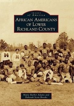
Lower Richland County encompasses approximately 360 square miles in the heart of South Carolina's geographic center. The Wateree River cradles it to the east, and the Congaree River borders the south and southwest. Virginia settlers discovered this rich land over 250 years ago. They became wealthy planters and accumulated large land tracts, creating plantation systems that sustained the economy. From 1783 until 1820, cotton was the principal cash crop, and the slave population increased tremendously and played a vital role in the development of agriculture and the economy in the area.

Produktbeschreibung
Lower Richland County encompasses approximately 360 square miles in the heart of South Carolina's geographic center. The Wateree River cradles it to the east, and the Congaree River borders the south and southwest. Virginia settlers discovered this rich land over 250 years ago. They became wealthy planters and accumulated large land tracts, creating plantation systems that sustained the economy. From 1783 until 1820, cotton was the principal cash crop, and the slave population increased tremendously and played a vital role in the development of agriculture and the economy in the area.
Hinweis: Dieser Artikel kann nur an eine deutsche Lieferadresse ausgeliefert werden.
Autorenporträt
Authors Marie Barber Adams and Deborah Scott Brooks are descendants of Lower Richland residents. Their grandmothers, Mamie Holley Barber and Minnie Holley Neal, respectively, were sisters and were born in Lower Richland shortly after slavery ended. The authors have been fortunate to find and preserve collections of images and documents belonging to their grandparents, parents, and relatives who recognized the value of oral and visual history. Others generously shared photographs to help tell these stories of tribulation, inspiration, and triumph. The authors hope to continually influence others to preserve and share the history of their beloved Lower Richland.