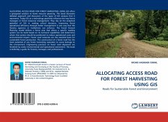
ALLOCATING ACCESS ROAD FOR FOREST HARVESTING USING GIS
Roads for Sustainable Forest and Environment
Versandkostenfrei!
Versandfertig in 6-10 Tagen
32,99 €
inkl. MwSt.

PAYBACK Punkte
16 °P sammeln!
ALLOCATING ACCESS ROAD FOR FOREST HARVESTING USING GIS offers a geospatial solution to forest resource planning. This book illustrates detailed approach and discussion of the types of GIS analysis that it represents. Today GIS as a technology positively influence the way forest managers in forest resources management. They rely on the analytical potential of GIS in making critical decisions. Improving forest operational efficiency through better management is one way that the forestry agencies or institutions can enhance. The Forest Harvest Planning model defines a forest area that allows a sp...
ALLOCATING ACCESS ROAD FOR FOREST HARVESTING USING GIS offers a geospatial solution to forest resource planning. This book illustrates detailed approach and discussion of the types of GIS analysis that it represents. Today GIS as a technology positively influence the way forest managers in forest resources management. They rely on the analytical potential of GIS in making critical decisions. Improving forest operational efficiency through better management is one way that the forestry agencies or institutions can enhance. The Forest Harvest Planning model defines a forest area that allows a specific roading system can be build based on its technical capabilities and determines where that system should be positioned to reduce operational costs and environmental impact. Forest road networks are the essential basis for sustainable forest production. The construction of a forest road has the most potential of any forest harvesting operation to cause damage to the environment. Engineering practices on forest road alignment are hindered by costly environmental and operational assessment. This book is definitely a guide for forestry managers and professionals.


