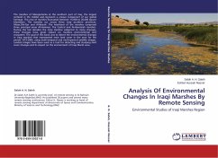
Analysis Of Environmental Changes In Iraqi Marshes By Remote Sensing
Environmental Studies of Iraqi Marshes Region
Versandkostenfrei!
Versandfertig in 6-10 Tagen
36,99 €
inkl. MwSt.

PAYBACK Punkte
18 °P sammeln!
The marshes of Mesopotamia at the southern part of Iraq, the largest wetland in the middel east,represent a unique component of our global heritage. The area of marshes fluctuated between 15,000 to 20,000 square kilometers. The marshes cut across three Iraqi southern provinces: Misan,Dhi-Qar and Al-Basrah. The heartland of the marshes comprised three principal areas Al-Hammar, The Central and Al-Hawaizah marshes. During the last decades the Iraqi marshes subjected to many changes, these changes have great impact on marshes environmental and ecosystem. The goal of this book was to detect the en...
The marshes of Mesopotamia at the southern part of Iraq, the largest wetland in the middel east,represent a unique component of our global heritage. The area of marshes fluctuated between 15,000 to 20,000 square kilometers. The marshes cut across three Iraqi southern provinces: Misan,Dhi-Qar and Al-Basrah. The heartland of the marshes comprised three principal areas Al-Hammar, The Central and Al-Hawaizah marshes. During the last decades the Iraqi marshes subjected to many changes, these changes have great impact on marshes environmental and ecosystem. The goal of this book was to detect the environmental changes in Iraqi marshes that represented main land cover in the area for the period 1973-2004, using multi-temporal and multi-spectral satellite images. Landsat images have been used as a tool for detecting and studying land cover changes and its impact on the environment of Iraqi Marsh area.


