44,99 €
inkl. MwSt.
Versandkostenfrei*
Versandfertig in 1-2 Wochen
payback
22 °P sammeln
  • Broschiertes Buch

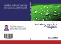
Remote Sensing and Geographic Information system (GIS) techniques are being effectively used as tools in defining the basin geometry. Integrated Results of morphometric analysis (MA), SYI model, USLE model have been used to prioritize watersheds and to locate sites for water harvesting structures in Savli and Kalol taluka, Gujarat, India are identified and considered for the study purpose. The location of water harvesting structure on natural drainage is directly depending on soil erosion intensity and ranks of micro- watersheds.

Produktbeschreibung
Remote Sensing and Geographic Information system (GIS) techniques are being effectively used as tools in defining the basin geometry. Integrated Results of morphometric analysis (MA), SYI model, USLE model have been used to prioritize watersheds and to locate sites for water harvesting structures in Savli and Kalol taluka, Gujarat, India are identified and considered for the study purpose. The location of water harvesting structure on natural drainage is directly depending on soil erosion intensity and ranks of micro- watersheds.
Hinweis: Dieser Artikel kann nur an eine deutsche Lieferadresse ausgeliefert werden.
Autorenporträt
Dr. Dhruvesh Patel is at present working as an Associate Professor of civil engineering department at S.P.B. Patel Engineering College, Saffrony Institute of Technology, Linch Mehsana. He has obtained his B.E. Civil, M.E. Civil (WRM) and Ph. D. Civil degrees from L.D. College of Engineering / Gujarat University.