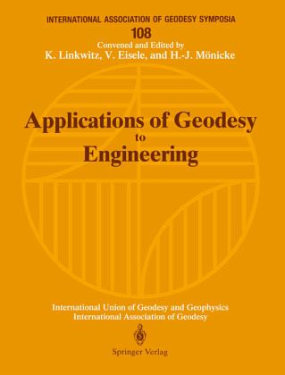
Accuracy requirements of fractions of a millimeter for thepositioning of beam-guiding magnets in synchrotons, monitor-ing of speedy sub-seatunnelling with lengths exceeding 25km, the construction of extremely long bridges of suspensionor "cast-and push"-type, but also geometrical industrialquality control and robot calibration in real time, and eventhe analysis of prestressed cable nets, are few examples ofthechallenging new tasks demanding responses from themodern engineering-geodesist.In this volume, a general view of Engineering Geologyispresented, its state of the art and up-to-date…mehr
Accuracy requirements of fractions of a millimeter for thepositioning of beam-guiding magnets in synchrotons, monitor-ing of speedy sub-seatunnelling with lengths exceeding 25km, the construction of extremely long bridges of suspensionor "cast-and push"-type, but also geometrical industrialquality control and robot calibration in real time, and eventhe analysis of prestressed cable nets, are few examples ofthechallenging new tasks demanding responses from themodern engineering-geodesist.In this volume, a general view of Engineering Geologyispresented, its state of the art and up-to-date informationabout recent scientific tasks, aims and methods. Thecontributions focus on Theoretical Aspects, Techniques ofMeasurements, Techniques of Data Processing and Computing,Reports About Selected Executed Projects, Special Tasks,e.g. Realtime Positioning and Navigation, IndustrialManagements,Image Processing. But also the role of geo-desists in collaboration with civil and mechanicalengineers, technical designers and architects is outlined.As a reference book, this volume will be useful forresearchers, students and practitioners in EngineeringGeodesy and neighbouring disciplines.Hinweis: Dieser Artikel kann nur an eine deutsche Lieferadresse ausgeliefert werden.
and Programme.- Theoretical Aspects.- Engineering Networks in a Threedimensional Reference Frame.- Tidal Corrections in Geodetic Height Determination.- Transferring the Bearing Using a Strapdown Inertial Measurement Unit.- GPS as a Tool for Engineering Applications of Geodesy.- Formfinding of Lightweight Surface Structures by Geodetic Methods.- Risk Analysis of Local Heterogeneous Networks.- The Estimation of Rigid-Body-Movements Around a 3D-Axis.- Three-Dimensional Kinematic Network for Deformation Measurements.- New Models of the Deformation Analysis (not included).- Modelling Rigid Body Motion from Kinematic Measurements (not included).- Techniques of Measurements.- Robot Techniques and their Impact on Surveying Systems.- A Unified Alignment Model for Rotating Machinery.- Measurements of High-Frequency Oscillations by Optoelectronic and Inertial Sensors in a Hybrid Measurement System.- Concept for a New Monitoring System for the Arch Dam Esch/Sauer.- System of Survey, Analysis and Interpretation of Rocky Block Deformations in the Mountains.- Setting Up a Levelling Network for the Detection of Reliable Subsidences.- Techniques of Data Processing and Computing.- Recent Developments with Respect to the Automated Processing and Analysis of Engineering Survey Data.- Computer Solution of Systems of Linear Equations in Engineering Geodesy.- Theoretical Foundations of Technology by Using the System Analogous Stereo Plotter and Personal Computers.- Earthwork Volume Determination by Terrestrial Photogrammetry.- Precise Levelling Network Adjustment in Mining Subsidence Regions.- Data Base Systems for Applications in Engineering (not included).- Reports About Selected Executed Projects.- Applied Geodesy for Particle Accelerators.- Geodetic Works for Large Structures in Venezuela.- A Digital Urban Space Model for Urban Planning and Management.- Geodetic Survey for Long Undersea Tunnel Construction.- Control Surveys During the Construction of the Channel Tunnel.- Height Transfer Across the Storebælt (Eastern Channel) Using Geometric Levelling, Trigonometric Heighting and Astronomic Methods in Combination with GPS (GPS Levelling).- Engineering Surveys for Construction of the Ems Tunnel.- Special Tasks, i.e. Realtime Positioning and Navigation, Industrial Measurements, Image Processing.- Application of Network Adjustment Techniques in Engineering.- Current Work on the Methods of Industrial Measurements Carried Out at the Institute of Geodesy and Cartography in Warsaw.- High-Precision Real-Time Differential Positioning Using Low-Cost GPS Receivers.- High Accuracy Edge Matching with an Extension of the MPGC-Matching Algorithm.- Simultaneous Adjustment for a Self-Calibration of a CCD Camera in a 2-D Field.- Chains of Elongated Figures as Control Networks in Mines and Tunnels.- Robot Vision Based on an Exact Solution of the Threedimensional Resection-Intersection.- Special Measurement Methods to Determination of the Dynamic Parameters in Bridge Systems.- Instrumentation for Bridge Tests.- The Role of the Geodesist in Collaboration with Civil and Mechanical Engineers, Technical Designers and Architects.- Contributions of the Surveyor to Improve Infrastructure in Developing Countries.- The Polynominal Approximation in Design of Rectification of the Roadway Overhead Crane.- State of the Art and Development of Engineering Geodesy and Activities of the FIG Commission 6.- Geodätische Vermessungen bei Montage, Stapellauf, und Betrieb von Schiffen und Meeres-Bohrinseln (not included).- Appendix - List of Participants.- Author Index.
Es gelten unsere Allgemeinen Geschäftsbedingungen: www.buecher.de/agb
Impressum
www.buecher.de ist ein Internetauftritt der buecher.de internetstores GmbH
Geschäftsführung: Monica Sawhney | Roland Kölbl | Günter Hilger
Sitz der Gesellschaft: Batheyer Straße 115 - 117, 58099 Hagen
Postanschrift: Bürgermeister-Wegele-Str. 12, 86167 Augsburg
Amtsgericht Hagen HRB 13257
Steuernummer: 321/5800/1497
USt-IdNr: DE450055826