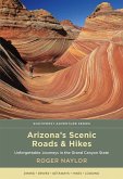
Explore some of the most spectacular scenic drives in Arizona in this unique guide to roadways across the state's tallest mountain ranges. With the help of state-of-the-art geographic information system (GIS) techniques, authors Robert and Evangeline Davis map Arizona's highest terrain and over 200 miles of paved roads above 8,000 feet in elevation. From the Pinaleno and Santa Catalina Mountains in the southeast to the majestic North Rim of the Grand Canyon, Arizona over 8,000 Feet highlights best routes, recreation areas, lookouts, and other key points of interest for travelers through 24 detailed maps, photographs, and brief descriptions of locations. Full color.
Hinweis: Dieser Artikel kann nur an eine deutsche Lieferadresse ausgeliefert werden.
Hinweis: Dieser Artikel kann nur an eine deutsche Lieferadresse ausgeliefert werden.


