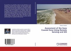
The increasing of the population density and the dependence of the inhabitants at the coastal zone has caused to worsening of several coastal environments overall the world. Therefore, this book describes several Remote Sensing and Geoinformatics techniques for assessing and studying t coastal environments from space. Satellite data were utilized to evaluate the coastal zone of the Gaza Strip, including automatic extraction of the shoreline, the pansharpening algorithms for enhancing the spatial quality of Satellite images, the calculation of the shoreline change rates, determination of the most threatened areas along the shoreline, derivation the bathymetric maps and mapping in the underwater sand bar structures. The Book demonstrates the power of remote sensing imagery to retrieve significant and considerable information about coastal water and seabed geomorphology in the shallow coastal regions. Additionally, the book provides valuable information and data about the rates of shoreline changes the location of threatened regions and the underwater sand bars geomorphology in the coastal zone of the Gaza Strip.
Bitte wählen Sie Ihr Anliegen aus.
Rechnungen
Retourenschein anfordern
Bestellstatus
Storno

