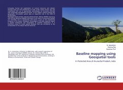
Baseline mapping using Geospatial tools
In Protected Area of Arunachal Pradesh, India
Versandkostenfrei!
Versandfertig in 6-10 Tagen
27,99 €
inkl. MwSt.

PAYBACK Punkte
14 °P sammeln!
Increasing human led exploitation of natural resources and climatic changes have put the biodiversity of India under severe threat. This has necessitated the use of appropriate technologies to formulate effective and sustainable management practices. In this regard, remote sensing and geographic information system play an important role in the field of conservation. Namdapha National Park, Mouling National Park, Mehao Wildlife Sanctuary and D'Ering Memorial Wildlife Sanctuary in the state of Arunachal Pradesh are extremely rich in biodiversity and forms a part of the biodiversity hotspots in t...
Increasing human led exploitation of natural resources and climatic changes have put the biodiversity of India under severe threat. This has necessitated the use of appropriate technologies to formulate effective and sustainable management practices. In this regard, remote sensing and geographic information system play an important role in the field of conservation. Namdapha National Park, Mouling National Park, Mehao Wildlife Sanctuary and D'Ering Memorial Wildlife Sanctuary in the state of Arunachal Pradesh are extremely rich in biodiversity and forms a part of the biodiversity hotspots in the Eastern Himalayas. Knowledge of this little explored region is grossly inadequate and necessitates its detailed exploration. It is therefore crucial to create spatial database that can contribute to the conservation of its unique natural resources.


