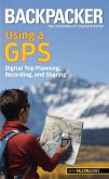
Richly illustrated and information-packed tools for anyone whose play or work takes them to remote areas. Basic Illustrated Using GPS, 3rd is a guide to practical field use of the Global Positioning System, written in simple language, with each new term explained as it's used. This book is a wealth of useful backcountry navigation advice for beginners and experts alike. It also includes information on using GPS with the latest mapping software.Discover how to: ¿ Pick the best GPS receiver for your specific needs ¿ Read and pregrid topographic maps ¿ Identify waypoints with various coordinate systems ¿ Use GPS to navigate on land and water ¿ Create your own maps with GPS software
Hinweis: Dieser Artikel kann nur an eine deutsche Lieferadresse ausgeliefert werden.
Hinweis: Dieser Artikel kann nur an eine deutsche Lieferadresse ausgeliefert werden.


