Big Data
Techniques and Technologies in Geoinformatics
Herausgeber: Karimi, Hassan A.
Big Data
Techniques and Technologies in Geoinformatics
Herausgeber: Karimi, Hassan A.
- Gebundenes Buch
- Merkliste
- Auf die Merkliste
- Bewerten Bewerten
- Teilen
- Produkt teilen
- Produkterinnerung
- Produkterinnerung
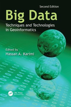
This revised new edition provides up-to-date knowledge on the latest developments related to these three fields for solving geoinformatics problems. There are seven new chapters, and each of them focuses on a separate real-world problem to which deep learning is applied.
Andere Kunden interessierten sich auch für
![Data Science with Semantic Technologies Data Science with Semantic Technologies]() Data Science with Semantic Technologies217,99 €
Data Science with Semantic Technologies217,99 €![Internet of Things and Big Data Analytics for a Green Environment Internet of Things and Big Data Analytics for a Green Environment]() Internet of Things and Big Data Analytics for a Green Environment153,99 €
Internet of Things and Big Data Analytics for a Green Environment153,99 €![Protecting Location Privacy in the Era of Big Data Protecting Location Privacy in the Era of Big Data]() Yan YanProtecting Location Privacy in the Era of Big Data88,99 €
Yan YanProtecting Location Privacy in the Era of Big Data88,99 €![Data Science with Semantic Technologies Data Science with Semantic Technologies]() Data Science with Semantic Technologies217,99 €
Data Science with Semantic Technologies217,99 €![AI for Big Data-Based Engineering Applications from Security Perspectives AI for Big Data-Based Engineering Applications from Security Perspectives]() AI for Big Data-Based Engineering Applications from Security Perspectives155,99 €
AI for Big Data-Based Engineering Applications from Security Perspectives155,99 €![Big Data Concepts, Technologies, and Applications Big Data Concepts, Technologies, and Applications]() Mohammad Shahid HusainBig Data Concepts, Technologies, and Applications150,99 €
Mohammad Shahid HusainBig Data Concepts, Technologies, and Applications150,99 €![Big Data Analytics in Fog-Enabled Iot Networks Big Data Analytics in Fog-Enabled Iot Networks]() Big Data Analytics in Fog-Enabled Iot Networks144,99 €
Big Data Analytics in Fog-Enabled Iot Networks144,99 €-
-
-
This revised new edition provides up-to-date knowledge on the latest developments related to these three fields for solving geoinformatics problems. There are seven new chapters, and each of them focuses on a separate real-world problem to which deep learning is applied.
Hinweis: Dieser Artikel kann nur an eine deutsche Lieferadresse ausgeliefert werden.
Hinweis: Dieser Artikel kann nur an eine deutsche Lieferadresse ausgeliefert werden.
Produktdetails
- Produktdetails
- Verlag: CRC Press
- 2. Auflage
- Seitenzahl: 410
- Erscheinungstermin: 1. August 2024
- Englisch
- Abmessung: 260mm x 183mm x 27mm
- Gewicht: 963g
- ISBN-13: 9781032525143
- ISBN-10: 1032525142
- Artikelnr.: 70145954
- Herstellerkennzeichnung
- Libri GmbH
- Europaallee 1
- 36244 Bad Hersfeld
- gpsr@libri.de
Hassan A. Karimi is a Professor and the Director of the Geoinformatics Laboratory in the School of Computing and Information at the University of Pittsburgh. He earned a PhD in geomatics engineering at the University of Calgary. Dr. Karimi's research interests include computational geometry and topology, machine learning, spatial data analytics, navigation techniques and applications, location-based services, mobile computing, and distributed/parallel computing. His research in geoinformatics has resulted in over 230 publications in peer-reviewed journals and conference proceedings, as well as in many workshops and presentations at national and international forums. Dr. Karimi has published the following books with Taylor & Francis: Geospatial Data Science Techniques and Applications (2018), Indoor Wayfinding and Navigation (2015), Big Data: Techniques and Technologies in Geoinformatics (2014), Advanced Location-Based Technologies and Services (2013), CAD and GIS Integration (2010), and Telegeoinformatics: Location-Based Computing and Services (2004). He has published Universal Navigation on Smartphones (2011) with Springer and Handbook of Research on Geoinformatics (2009) with IGI.
1. Distributed and Parallel Computing. 2. GEOSS Clearinghouse Integrating
Geospatial Resources to Support the Global Earth Observation System of
Systems. 3. Using a Cloud Computing Environment to Process Large 3D Spatial
Datasets. 4. Building Open Environments to Meet Big Data Challenges in
Earth Sciences. 5. Developing Online Visualization and Analysis Services
for NASA Satellite-Derived Global Precipitation Products during the Big
Geospatial Data Era. 6. Algorithmic Design Considerations for Geospatial
and/or Temporal Big Data. 7. Machine Learning on Geospatial Big Data. 8.
Spatial Big Data: Case Studies on Volume, Velocity, and Variety. 9.
Exploiting Big VGI to Improve Routing and Navigation Services. 10.
Efficient Frequent Sequence Mining on Taxi Trip Records Using Road Network
Shortcuts. 11. Geoinformatics and Social Media: New Big Data Challenge. 12.
Insights and Knowledge Discovery from Big Geospatial Data Using
TMC-Pattern. 13. Geospatial Cyberinfrastructure for Addressing the Big Data
Challenges on the Worldwide Sensor Web. 14. OGC Standards and Geospatial
Big Data. 15. Advanced Deep Learning Models and Algorithms for
Spatial-Temporal Data. 16. Deep Learning for Spatial Data: Heterogeneity
and Adaptation. 17. Assessing Multilevel Environmental and Air Quality
Changes in Australia Pre- and Post-COVID-19 Lockdown: A Spatial Machine
Learning Approach Utilizing Earth Observation Data. 18. Fairness-Aware Deep
Learning in Space. 19. Integrating Large Language Models and Qualitative
Spatial Reasoning. 20. Toward a Spatial Metaverse: Building Immersive
Virtual Experiences with Georeferenced Digital Twin and Game Engine. 21. A
Topological Machine Learning Approach with Multichannel Integration for
Detecting Geospatial Objects.

