18,99 €
inkl. MwSt.
Versandfertig in über 4 Wochen

9 °P sammeln
- Broschiertes Buch
- Merkliste
- Auf die Merkliste
- Bewerten Bewerten
- Teilen
- Produkt teilen
- Produkterinnerung
- Produkterinnerung
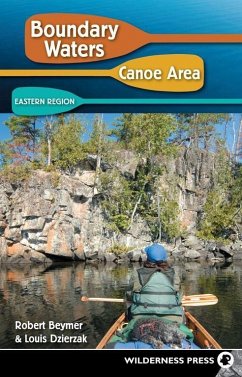
This guide describes 28 entry points in the eastern part of the BWCA Wilderness-those accessible near Grand Marais from the Sawbill Trail and the Gunflint Trail.
Andere Kunden interessierten sich auch für
![Exploring the Boundary Waters Exploring the Boundary Waters]() Daniel PaulyExploring the Boundary Waters21,99 €
Daniel PaulyExploring the Boundary Waters21,99 €![Alabama Canoe Rides and Float Trips Alabama Canoe Rides and Float Trips]() John FosheeAlabama Canoe Rides and Float Trips18,99 €
John FosheeAlabama Canoe Rides and Float Trips18,99 €![A Falconguide(r) to Everglades National Park and the Surrounding Area A Falconguide(r) to Everglades National Park and the Surrounding Area]() Roger L HammerA Falconguide(r) to Everglades National Park and the Surrounding Area12,99 €
Roger L HammerA Falconguide(r) to Everglades National Park and the Surrounding Area12,99 €![One Night Wilderness: San Francisco Bay Area One Night Wilderness: San Francisco Bay Area]() Matt HeidOne Night Wilderness: San Francisco Bay Area15,99 €
Matt HeidOne Night Wilderness: San Francisco Bay Area15,99 €![Rail-Trails Iowa & Missouri Rail-Trails Iowa & Missouri]() Rails-To-Trails ConservancyRail-Trails Iowa & Missouri16,99 €
Rails-To-Trails ConservancyRail-Trails Iowa & Missouri16,99 €![Walking Twin Cities Walking Twin Cities]() Holly DayWalking Twin Cities16,99 €
Holly DayWalking Twin Cities16,99 €![Rail-Trails Pennsylvania Rail-Trails Pennsylvania]() Rails-To-Trails ConservancyRail-Trails Pennsylvania17,99 €
Rails-To-Trails ConservancyRail-Trails Pennsylvania17,99 €-
-
-
This guide describes 28 entry points in the eastern part of the BWCA Wilderness-those accessible near Grand Marais from the Sawbill Trail and the Gunflint Trail.
Hinweis: Dieser Artikel kann nur an eine deutsche Lieferadresse ausgeliefert werden.
Hinweis: Dieser Artikel kann nur an eine deutsche Lieferadresse ausgeliefert werden.
Produktdetails
- Produktdetails
- Verlag: Wilderness Press
- 5th edition
- Seitenzahl: 280
- Erscheinungstermin: 9. Juli 2009
- Englisch
- Abmessung: 213mm x 140mm x 18mm
- Gewicht: 341g
- ISBN-13: 9780899974613
- ISBN-10: 0899974619
- Artikelnr.: 23861766
- Herstellerkennzeichnung
- Libri GmbH
- Europaallee 1
- 36244 Bad Hersfeld
- gpsr@libri.de
Robert Beymer has been a frequent visitor to the Boundary Waters Cano Area Wilderness for the past 40 years, and was a canoe trip guide for seven summers at a private camp near Ely. He and his wife, Cheryl, have lived on the edge of the wilderness since 1984. Their home serves as a convenient starting point for day trips by canoe, as well as on foot, snowshoes, and cross-country skis. In addition to his two volume guide to the Boundary Waters Canoe Area, Bob has written three other books about the Quetico-Superior region of northeastern Minnesota and Ontario. His articles have appeared in numerous outdoor magazines, including Boundary Waters Journal, Silent Sports Magazine, Camping Journal, and Minneapolis-St. Paul Magazine. When the muse screaming in his ear was too loud to ignore, Louis Dzierzak walked away from a successful advertising career to become a full-time freelance writer. He's written about issues and trends in outdoor recreation for over a decade. Lou firmly believes that paddling in the Boundary Waters Canoe Area is the best way to recover from constant publishing deadlines.
Acknowledgments
locator Map of Boundary Water Canoe Area: Eastern Region
Prefaces
Chapter 1: introduction to the BWCA Wilderness
Chapter 2: How to Plan a Wilderness Canoe trip
Chapter 3: Entry from the Sawbill Trail
* Entry Point 36-Hog Creek
* Entry Point 37-Kawishiwi Lake
* Entry Point 38-Sawbill Lake
* Entry Point 39-Baker Lake
* Entry Point 40-Homer Lake
* Entry Point 41-Brule Lake
Chapter 4: Entry from the Gunflint Trail-West
* Entry Point 43-Bower Trout Lake
* Entry Point 44-Ram Lake
* Entry Point 45-Morgan Lake
* Entry Point 47-Lizz Lake & Swamp Lake
* Entry Point 48-Meeds Lake
* Entry Point 49-Skipper Lake & Portage Lake
* Entry Point 50-Cross Bay Lake
* Entry Point 51-Missing Link Lake
* Entry Point 52-Brant Lake
* Entry Point 54-Seagull Lake
* Entry Point 55-Saganaga Lake
Chapter 5: Entry from the Gunflint Trail-East and Arrowhead trail
* Entry Point 80-Larch Creek
* Entry Point 57-Magnetic Lake
* Entry Point 58-South Lake
* Entry Point 60-Duncan Lake
* Entry Point 61-Daniels Lake
* Entry Point 62-Clearwater Lake
* Entry Point 64-East Bearskin Lake
* Entry Point 66-Crocodile River
* Entry Point 68-Pine Lake
* Entry Point 69-John Lake
* Entry Point 70-North Fowl Lake
Appendix i: Routes Categorized by Difficulty and Duration
Appendix ii: Commercial Canoe trip outfitters
Appendix iii: lake index for fishing
Appendix iV: BWCAW Hiking trails in the Eastern Region
Appendix V: More Resources
Photo Credits
Index
