Timothy Bauer
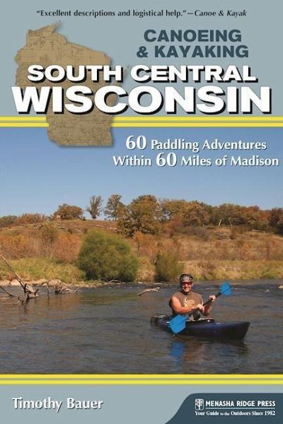
Canoeing & Kayaking South Central Wisconsin
60 Paddling Adventures Within 60 Miles of Madison
16,99 €
inkl. MwSt.
Versandfertig in über 4 Wochen
Timothy Bauer
Canoeing & Kayaking South Central Wisconsin
60 Paddling Adventures Within 60 Miles of Madison
- Broschiertes Buch
- Merkliste
- Auf die Merkliste
- Bewerten Bewerten
- Teilen
- Produkt teilen
- Produkterinnerung
- Produkterinnerung
This authoritative guide to the waterways of Wisconsin presents many of the state's paddleable waterways in 60 paddling adventures that include everything from new maps and GPS coordinates to access points, river gauges, and mileages.
Andere Kunden interessierten sich auch für
- Suzanne WelanderCanoeing & Kayaking Georgia22,99 €
- Bob SehlingerCanoeing & Kayaking Kentucky16,99 €
- Kevin StiegelmaierPaddling Long Island and New York City17,99 €
- Joe CookBroad River User's Guide20,99 €
- Jeff CountsThe Paddler's Guide to Michigan16,99 €
- Joe CookEtowah River User's Guide21,99 €
- Holly GenzenPaddling the Everglades Wilderness Waterway14,99 €
-
-
-
This authoritative guide to the waterways of Wisconsin presents many of the state's paddleable waterways in 60 paddling adventures that include everything from new maps and GPS coordinates to access points, river gauges, and mileages.
Hinweis: Dieser Artikel kann nur an eine deutsche Lieferadresse ausgeliefert werden.
Produktdetails
- Produktdetails
- Verlag: Menasha Ridge Press
- Seitenzahl: 364
- Erscheinungstermin: 30. August 2016
- Englisch
- Abmessung: 226mm x 150mm x 20mm
- Gewicht: 476g
- ISBN-13: 9781634040204
- ISBN-10: 1634040201
- Artikelnr.: 43748667
- Verlag: Menasha Ridge Press
- Seitenzahl: 364
- Erscheinungstermin: 30. August 2016
- Englisch
- Abmessung: 226mm x 150mm x 20mm
- Gewicht: 476g
- ISBN-13: 9781634040204
- ISBN-10: 1634040201
- Artikelnr.: 43748667
Water lover and outdoors enthusiast Timothy Bauer has been paddling around Wisconsin and the neighboring states with great wanderlust since 2008, always eager to explore uncharted streams but ever grateful for the familiar favorites. Originally from the suburbs of New Jersey (Exit 159), he has gladly made Madison his home since 2003.
Trip List * Northeast of Madison * Beaver Dam River: Beaver Dam to County Road J * Craw
sh River A: Columbus to Astico Park * Craw
sh River B: County Road I to County Road G * Duck Creek: Wyocena to Duck Creek Road * Fox River A: Indian Hills Campground to Portage Canal * Fox River B: Portage to Büalo in Columbia and Marquette Counties * Horicon Marsh: Greenhead Landing to Bowling Green Park * Maunesha River: Marshall to Waterloo * Mecan River: 11th Road to Dixie Avenue * Montello River: County Road J to Montello Lake Boat Landing * Oconomowoc River: Loew Lake * Puchyan River: Green Lake Dam to County Road J * Rock River: Harnischfeger Park to Kanow Park * Rocky Run Creek and Wisconsin River: US 51 to County Road V * Token Creek: Portage Road to Cherokee Marsh * White River (Green Lake County): Neshkoro Dam to White River Road * Yahara River A: DeForest to Windsor * Southeast of Madison * Bad
sh Creek: Old Stage Road to Casey Road * Bark River A: Nemahbin Lake to Atkins-Olson Memorial Park * Bark River B: Rome Dam to Hebron * Bark River C: Koch Road to Burnt Village Park * Illinois Fox River: County Road H to County Road ES * Koshkonong Creek: Cambridge to Hoopen Road * Mukwonago River: County Road LO to County Road I * Pewaukee River and Illinois Fox River: Pewaukee to Waukesha * Red Cedar Lake State Natural Area: Cambridge in Je
erson County * Sugar River C: Avon Bottoms to Yale Bridge Road in Illinois * Turtle Creek A: Fair
eld Area in Walworth and Rock Counties * Turtle Creek B: South O'Riley Road to Sweet-Allyn Park * Turtle Creek C: Sweet-Allyn Park to Dickop Street in Illinois * White River (Walworth County): Sheridan Springs Road to Burlington * Yahara River B: Dunkirk Dam to Rock River * Southwest of Madison * Governor Dodge State Park: Cox Hollow and Twin Valley Lakes * Little Platte River: Quarry Road to County Road O * Little Sugar River: Schneeberger Road to Albany * Pecatonica River A: County Road O to Darlington * Pecatonica River B: Roller Coaster Road to Walnut Road * Pecatonica River East Branch A: Hollandale to Blanchardville * Pecatonica River East Branch B: Blanchardville to Argyle * Pecatonica River East Branch C: Argyle to Blackhawk Memorial Park * Platte River: Platte Road to Big Platte Road * Sugar River A: Verona to Paoli in Dane County * Sugar River B: Brodhead Dam to Avon Bottoms * Baraboo River A: Wonewoc to La Valle * Baraboo River B: La Valle to Lake Redstone * Baraboo River C: Rock Springs to North Freedom * Baraboo River D: Baraboo Rapids * Black Earth Creek: Olson Road to Lions Park * Dell Creek and Mirror Lake: Dellwood and Lake Delton in Sauk County * Devil's Lake State Park: Baraboo in Sauk County * Lemonweir River: Mauston Dam to Two Rivers Boat Landing * Neenah Creek A: Chauncey Street to County Road A * Neenah Creek B: County Road P to Muskrat Road * Neenah Creek C: Muskrat Road to County Road CX * Pine River A: Pier Natural Bridge Park to County Road AA * Pine River B: County Road AA to Bohmann Drive * Pine River C: Twin Blüs Drive to Wisconsin River * Wisconsin River A: Upper and Lower Dells * Wisconsin River B: Prairie du Sac Dam to Spring Green * Wisconsin River C: Lone Rock to Blue River