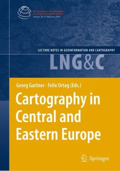
Cartography in Central and Eastern Europe
Selected Papers of the 1st ICA Symposium on Cartography for Central and Eastern Europe
Herausgegeben:Gartner, Georg; Ortag, Felix
Cartography in Central and Eastern Europe
Selected Papers of the 1st ICA Symposium on Cartography for Central and Eastern Europe
Herausgegeben:Gartner, Georg; Ortag, Felix
- Gebundenes Buch
- Merkliste
- Auf die Merkliste
- Bewerten Bewerten
- Teilen
- Produkt teilen
- Produkterinnerung
- Produkterinnerung
The region of Central and Eastern Europe has a rich and long history in cart- raphy. Many important improvements in mapping and cartography have been proposed and performed by cartographers and researchers of that region. The long and outstanding history has led to a lively and vivid presence. Now contemporary methods for depicting the earth and its cultural and natural attributes are used. This book focuses on the contemporary activities in all major realms of cartography in Central and Eastern Europe. It covers aspects of theoretical, topographical, thematic and multimedia cartography, which…mehr
- Cartography in Central and Eastern Europe147,99 €
- Geographic Information and Cartography for Risk and Crisis Management110,99 €
- Geospatial Thinking110,99 €
- The European Information Society125,99 €
- Geospatial Thinking110,99 €
- Gerhard Navratil (Volume editor)Research Trends in Geographic Information Science110,99 €
-
-
-
Hinweis: Dieser Artikel kann nur an eine deutsche Lieferadresse ausgeliefert werden.
- Produktdetails
- Lecture Notes in Geoinformation and Cartography
- Verlag: Springer / Springer Berlin Heidelberg / Springer, Berlin
- Artikelnr. des Verlages: 12663361, 978-3-642-03293-6
- 2009
- Seitenzahl: 592
- Erscheinungstermin: 25. November 2009
- Englisch
- Abmessung: 241mm x 160mm x 41mm
- Gewicht: 1127g
- ISBN-13: 9783642032936
- ISBN-10: 3642032931
- Artikelnr.: 26899697
Topographic Mapping.
EuroRegionalMap #x2013; How to Succeed in Overcoming National Borders.
Methods of Portraying Spatial Data Used in Official Geoinformation Services in Poland #x2013; A Comparative Study.
Compilation of Digital Elevation Model for Turkey in 3
Arc
Second Resolution by Using SRTM Data Supported with Local Elevation Data.
Mapping Land Cover with Commercial and Freeware Image Classification Software #x2013; An Example from Bavaria, Germany.
New Approach to Multi Scale Cartographic Modelling of Reference and Thematic Databases in Poland.
Implementation of the INSPIRE
Directive in Germany and Poland #x2013; Legal Point of View.
Cartographic Modelling.
Automated Building Simplification Using a Recursive Approach.
Constraint
Based Evaluation of Automated and Manual Generalised Topographic Maps.
Cross
Border Mapping: Geodata, Geonames, Multilinguality and More.
XSLT Templates for Thematic Maps.
Geoinformational Methods in Ecodiagnostical Studies for the Losiny Ostrov National Park Territory.
Cartography and Graphic Design.
Various Ways of Assessment of Cartographic Works.
Multimedia Cartography.
Exploring Space: Applying Interactive Integrated Media for Visualising Geography.
The Art of Autostereoscopic Relief Representation in Cartography.
Approaches to Image Abstraction for Photorealistic Depictions of Virtual 3D Models.
Globes on the Web #x2013; Technical Background and First Items of the Virtual Globes Museum.
Mapping Crime Using Geovirtual Urban Environments.
A Survey of Mobile Indoor Navigation Systems.
Atlas Cartography.
Mapping Space
Related Transformation Processes in Eastern Europe. Examples from the Atlas of Eastern and Southeastern Europe.
The Demographic Atlas of Croatia #x2013; A Web
Based Atlas Information System.
Mapping and Analysing the Local Language Areas for Slovenian Linguistic Atlas.
Interactive and Multimedia Atlas Information Systems as a Cartographic Geo
Communication Platform.
Cartographic Applications.
Integration of Hightech Components for Operating Ragweed Mapping and Control System in Hungary Using Remote Sensing and GIS.
Detailed Mapping of Landslide Susceptibility for Urban Planning Purposes in Carpathian and Subcarpathian Towns of Romania.
Dynamic Cartographic Methods for Visualisation of Health Statistics.
A Multiresolution, Reference and Thematic Database as the NSDI Component in Poland #x2013; The Concept and Management Systems.
The Remote Sensing Based Hungarian Crop Production Forecast Program (Cropmon) and its Other Applications.
The Blind Mouse #x2013; A Game for Developing and Popularizing Cartographical Skills.
Historical Cartography.
Orientation of the Map of Lazarus (1528) of Hungary #x2013; Result of the Ptolemian Projection?.
History of the Hungarian Geological Maps #x2013; An Overview from the 18 Century to Nowadays.
Cartometric Analysis of Old Maps on the Example of Vogt#x2019;s Map.
Structural Lineaments Derived from Planforms of Watercourses in the Second Military Survey of the Habsburg Empire.
The Austro
Hungarian Triangulations in the Balkan Peninsula (1855#x2013;1875).
Maps of Czech Lands in the Period 1518#x2013;1720 from the Map Collection of Charles University in Prague.
The Dilemma for the History of Modern Maps Based on Neo
Cartographic Technologies.