Colorado River
Versandkostenfrei!
Versandfertig in 6-10 Tagen
23,99 €
inkl. MwSt.

PAYBACK Punkte
12 °P sammeln!
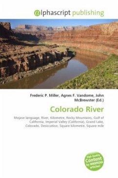
High Quality Content by WIKIPEDIA articles! The Colorado River ('Aha Kwahwat in Mojave), or the Red River, is a river in the southwestern United States and northwestern Mexico, approximately 2,330 km (1,450 mi) long, draining a part of the arid regions on the western slope of the Rocky Mountains. The natural course of the river flows from 25 km (16 mi) north of Grand Lake, Colorado into the Gulf of California, but the heavy use of the river as an irrigation source for the Imperial Valley has desiccated the lower course of the river in Mexico such that it no longer consistently reaches the sea....
High Quality Content by WIKIPEDIA articles! The Colorado River ('Aha Kwahwat in Mojave), or the Red River, is a river in the southwestern United States and northwestern Mexico, approximately 2,330 km (1,450 mi) long, draining a part of the arid regions on the western slope of the Rocky Mountains. The natural course of the river flows from 25 km (16 mi) north of Grand Lake, Colorado into the Gulf of California, but the heavy use of the river as an irrigation source for the Imperial Valley has desiccated the lower course of the river in Mexico such that it no longer consistently reaches the sea. The watershed of the Colorado River covers 629,100 km2 (242,900 sq mi) in parts of seven U.S. states and two Mexican provinces. Total flows of the river range from 113 m3/s (4,000 cu ft/s) in droughts to 28,000 m3/s (990,000 cu ft/s) in severe floods. With the construction of massive power dams on the lower course of the river, flows of over 2,000 m3/s (71,000 cu ft/s) are unusual. The meanflow of the river was 620 m3/s (22,000 cu ft/s) during the period between 1903-34. From 1951-80, the average flow was less than 110 m3/s (3,900 cu ft/s). Historically the flow was much higher before water usage began in the basin.


