- Gebundenes Buch
- Merkliste
- Auf die Merkliste
- Bewerten Bewerten
- Teilen
- Produkt teilen
- Produkterinnerung
- Produkterinnerung
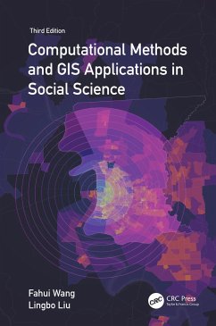
Integrates GIS, spatial analysis, and computational methods for solving real-world problems in various policy-relevant social science applications. Thoroughly updated, the third edition showcases the best practices of computational spatial social science and includes new examples and case studies with step-by-step instructions in ArcGIS Pro.
Andere Kunden interessierten sich auch für
![Social Data Analytics in the Cloud with AI Social Data Analytics in the Cloud with AI]() Xuebin WeiSocial Data Analytics in the Cloud with AI97,99 €
Xuebin WeiSocial Data Analytics in the Cloud with AI97,99 €![Online GIS and Spatial Metadata Online GIS and Spatial Metadata]() Terry BossomaierOnline GIS and Spatial Metadata172,99 €
Terry BossomaierOnline GIS and Spatial Metadata172,99 €![Explainable Machine Learning for Geospatial Data Analysis Explainable Machine Learning for Geospatial Data Analysis]() Courage KamusokoExplainable Machine Learning for Geospatial Data Analysis136,99 €
Courage KamusokoExplainable Machine Learning for Geospatial Data Analysis136,99 €![Principles of Modeling Uncertainties in Spatial Data and Spatial Analyses Principles of Modeling Uncertainties in Spatial Data and Spatial Analyses]() Wenzhong ShiPrinciples of Modeling Uncertainties in Spatial Data and Spatial Analyses213,99 €
Wenzhong ShiPrinciples of Modeling Uncertainties in Spatial Data and Spatial Analyses213,99 €![Computational Intelligence in Urban Infrastructure Computational Intelligence in Urban Infrastructure]() Computational Intelligence in Urban Infrastructure135,99 €
Computational Intelligence in Urban Infrastructure135,99 €![Fundamentals of Spatial Analysis and Modelling Fundamentals of Spatial Analysis and Modelling]() Jay GaoFundamentals of Spatial Analysis and Modelling135,99 €
Jay GaoFundamentals of Spatial Analysis and Modelling135,99 €![Remote Sensing Image Processing Algorithms for Detecting Air Turbulence Patterns Remote Sensing Image Processing Algorithms for Detecting Air Turbulence Patterns]() Maged MarghanyRemote Sensing Image Processing Algorithms for Detecting Air Turbulence Patterns173,99 €
Maged MarghanyRemote Sensing Image Processing Algorithms for Detecting Air Turbulence Patterns173,99 €-
-
-
Integrates GIS, spatial analysis, and computational methods for solving real-world problems in various policy-relevant social science applications. Thoroughly updated, the third edition showcases the best practices of computational spatial social science and includes new examples and case studies with step-by-step instructions in ArcGIS Pro.
Produktdetails
- Produktdetails
- Verlag: Taylor & Francis Ltd (Sales)
- 3rd edition
- Seitenzahl: 413
- Erscheinungstermin: 16. August 2023
- Englisch
- Abmessung: 234mm x 156mm x 25mm
- Gewicht: 794g
- ISBN-13: 9781032266817
- ISBN-10: 1032266813
- Artikelnr.: 67823902
- Herstellerkennzeichnung
- Libri GmbH
- Europaallee 1
- 36244 Bad Hersfeld
- gpsr@libri.de
Fahui Wang is Associate Dean of the Pinkie Gordon Lane Graduate School and Cyril and Tutta Vetter Alumni Professor in the Department of Geography and Anthropology, Louisiana State University. He earned a BS in geography at Peking University, China, and an MA in economics and a PhD in city and regional planning at the Ohio State University. His research has revolved around the broad theme of spatially integrated computational social sciences, public policy, and planning in geographic information systems. He is among the top 1% most-cited researchers in geography in the world. Lingbo Liu is Postdoctoral Fellow at the Center for Geographic Analysis, Harvard University, leading the development of Geospatial Analytics Extension for KNIME. He was a lecturer at the Department of Urban Planning, School of Urban Design, Wuhan University, from 2005 to 2022, and earned a PhD in digital urban administration and planning at Wuhan University in 2018. His research uses multi-source data and quantitative models to capture the spatiotemporal features of urban systems and provides decision support for public policy, sustainable urban planning, and design.
Part I: GIS and Basic Spatial Analysis Tasks. 1. Getting Started with
ArcGIS: Data Management and Basic Spatial Analysis Tools. 2. Measuring
Distance and Travel Time and Analyzing Distance Decay Behavior. 3. Spatial
Smoothing and Spatial Interpolation. Part II: Basic Computational Methods
and Applications. 4. Delineating Functional Regions and Application in
Health Geography. 5. GIS-Based Measures of Spatial Accessibility and
Application in Examining Healthcare Disparity. 6. Function Fittings by
Regressions and Application in Analyzing Urban Density Patterns. 7.
Principal Components, Factor Analysis, and Cluster Analysis and Application
in Social Area Analysis. 8. Spatial Statistics and Applications. 9.
Regionalization Methods and Application in Analysis of Cancer Data. Part
III: Advanced Computational Methods and Applications. 10. System of Linear
Equations and Application of the Garin-Lowry Model in Simulating Urban
Population and Employment Patterns. 11. Linear and Quadratic Programming
and Applications in Examining Wasteful Commuting and Allocating Healthcare
Providers. 12. Monte Carlo Method and Applications in Urban Population and
Traffic Simulations. 13. Agent-Based Model and Application in Crime
Simulation. 14. Spatiotemporal Big Data Analytics and Applications in Urban
Studies.

