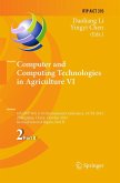
Computer and Computing Technologies in Agriculture VI
6th IFIP TC WG 5.14 International Conference, CCTA 2012, Zhangjiajie, China, October 19-21, 2012, Revised Selected Papers, Part II
Herausgegeben:Li, Daoliang; Chen, Yingyi
Computer and Computing Technologies in Agriculture VI
6th IFIP TC WG 5.14 International Conference, CCTA 2012, Zhangjiajie, China, October 19-21, 2012, Revised Selected Papers, Part II
Herausgegeben:Li, Daoliang; Chen, Yingyi
- Gebundenes Buch
- Merkliste
- Auf die Merkliste
- Bewerten Bewerten
- Teilen
- Produkt teilen
- Produkterinnerung
- Produkterinnerung
The two-volume set IFIP AICT 392 and 393 constitutes the refereed post-conference proceedings of the 6th IFIP TC 5, SIG 5.1 International Conference on Computer and Computing Technologies in Agriculture, CCTA 2012, held in Zhangjiajie, China, in October 2012. The 108 revised papers presented were carefully selected from numerous submissions. They cover a wide range of interesting theories and applications of information technology in agriculture, including Internet of things and cloud computing; simulation models and decision-support systems for agricultural production; smart sensor,…mehr
Andere Kunden interessierten sich auch für
![Computer and Computing Technologies in Agriculture VI Computer and Computing Technologies in Agriculture VI]() Computer and Computing Technologies in Agriculture VI75,99 €
Computer and Computing Technologies in Agriculture VI75,99 €![Computer and Computing Technologies in Agriculture VI Computer and Computing Technologies in Agriculture VI]() Computer and Computing Technologies in Agriculture VI75,99 €
Computer and Computing Technologies in Agriculture VI75,99 €![Computer and Computing Technologies in Agriculture VI Computer and Computing Technologies in Agriculture VI]() Computer and Computing Technologies in Agriculture VI75,99 €
Computer and Computing Technologies in Agriculture VI75,99 €![Computer and Computing Technologies in Agriculture IX Computer and Computing Technologies in Agriculture IX]() Computer and Computing Technologies in Agriculture IX76,99 €
Computer and Computing Technologies in Agriculture IX76,99 €![Computer and Computing Technologies in Agriculture IX Computer and Computing Technologies in Agriculture IX]() Computer and Computing Technologies in Agriculture IX76,99 €
Computer and Computing Technologies in Agriculture IX76,99 €![Computer and Computing Technologies in Agriculture IX Computer and Computing Technologies in Agriculture IX]() Computer and Computing Technologies in Agriculture IX75,99 €
Computer and Computing Technologies in Agriculture IX75,99 €![Computer and Computing Technologies in Agriculture IX Computer and Computing Technologies in Agriculture IX]() Computer and Computing Technologies in Agriculture IX76,99 €
Computer and Computing Technologies in Agriculture IX76,99 €-
-
-
The two-volume set IFIP AICT 392 and 393 constitutes the refereed post-conference proceedings of the 6th IFIP TC 5, SIG 5.1 International Conference on Computer and Computing Technologies in Agriculture, CCTA 2012, held in Zhangjiajie, China, in October 2012. The 108 revised papers presented were carefully selected from numerous submissions. They cover a wide range of interesting theories and applications of information technology in agriculture, including Internet of things and cloud computing; simulation models and decision-support systems for agricultural production; smart sensor, monitoring, and control technology; traceability and e-commerce technology; computer vision, computer graphics, and virtual reality; the application of information and communication technology in agriculture; and universal information service technology and service systems development in rural areas. The 55 papers included in the second volume focus on GIS, GPS, RS, and Precision Farming.
Produktdetails
- Produktdetails
- IFIP Advances in Information and Communication Technology 393
- Verlag: Springer / Springer Berlin Heidelberg / Springer, Berlin
- Artikelnr. des Verlages: 978-3-642-36136-4
- 2013
- Seitenzahl: 508
- Erscheinungstermin: 9. Februar 2013
- Englisch
- Abmessung: 241mm x 160mm x 32mm
- Gewicht: 890g
- ISBN-13: 9783642361364
- ISBN-10: 3642361366
- Artikelnr.: 36891895
- Herstellerkennzeichnung
- Springer-Verlag GmbH
- Tiergartenstr. 17
- 69121 Heidelberg
- ProductSafety@springernature.com
Remote Sensing of Forest LAI from Multitemporal Optical Satellite Images over Mountain Area.- A Sampling Design for Monitoring of the Cultivated Areas of Main Crops at National Scale Based 3S Technologies in China.- A Discussion on Spatial Distribution Differentiation Law of Peanut Quality in China Based on GIS Technology.- Research and Implementation of Measurement Data Wavelet De-noising and 3D Visualization of Remote Sensing Recognition of Paddy Waterlogging Using Change Vector Analysis Model.- The Simulation Models of Nitrogen Accumulation and Partitioning in Plant for Protected Cultivated.- Systematic Random Deployment for Wireless Sensor Network in Agricultural Sampling-Interpolation Applications.- Using EPIC Model to Determine a Sustainable Potato/Cereal Cropping System in the Arid Region of the Loess Plateau of China Using Sequential Gaussian Simulation to Assess Geochemical Anomaly Areas of Lead Element.- Study on Bee Product Quality Control Chain Based on Agent.- A Study of Agricultural Zoning of Huang-Huai-Hai Plain Based on GIS.- Particle Swarm Optimization Algorithm Establish the Model of Tobacco Ingredients in Near Infrared Spectroscopy Quantitative Grain Moisture Sensor Data Fusion Based on Improved Radial Basis Function Neural Network.- Application of Quadratic Rotation-Orthogonal Composite Experimental Design to Assess the Relationship between Growth Environment and Ultraweak Luminescence of Mint.- Application of Quadratic Rotation-Orthogonal Composite Experimental Design to Assess the Relationship between Growth Environment and Ultraweak Luminescence of Osmanthus Tree Seedlings.- Construction of Monitoring System of Dangerous and Harmful Species of Import Taiwan Fruits and Vegetables Based on GIS.- Design and Experiment of NIR Wheat Quality Quick Detection System.- Research on Prediction Model and Characteristic Parameters on Dry Matter Accumulation in Wheat Based on Normalized Method and Grey System.- Spatial Optimization and Mode Analysis of Primary Industry Structure in Yellow River Delta.-Intellectualized Identifying and Precision Control System for Horticultural Crop Diseases Based on Small Unmanned Aerial Vehicle.- Creating Topologically Consistent 3D City Models of LOD+ with Extrusion.- Design and Realization of Agricultural Information Intelligent Processing and Application.- Research of Determination Method of Starch and Protein Content in Buckwheat by Mid-Infrared Spectroscopy.- Research Progress of Grain Quality Nondestructive Testing Methods.- Maize Disease Diagnosis Model Based on Ontology and Multi-Agent.- Research on the Method of Feature-Based Multi-scale Vector Data Model.- A New Navigation Line Extraction Method for Agriculture Implements Guidance System.- Definition and Standardization of Data Elements' Attributes in Land and Resources Management.- Design of Monitoring Network for Cultivated Land Quality in County Area Based on Kriging Estimation Variance.- The Potential Geographical Distribution of Bactrocera cucurbitae (Diptera: Tephritidae) in China Based on Eclosion Rate Model and ArcGIS.- Visual Space Research and Application of the Data Mining in Soil Fertility Evaluation.- Research on Construction and SWRL Reasoning of Ontology of Maize Diseases.- Quantifying the Type of Urban Sprawl and Dynamic Changes in Shenzhen.- Extraction of Water Body Based on LandSat TM5 Imagery - A Case Study in the Yangtze River.- Validation and Application of Model ISAREG in a Typical Semiarid Sand-Meadow Area of Horqin Sandy Land.- Correlations between Nitrogen Content and Multispectral Image of Greenhouse Cucumber Grown in Different Nitrogen Level.- A New Approach for Fast Calculation of Sloped Terrace Earthwork Based on GIS in the Hilly Regions.- The Estimation of Tree Height Based on LiDAR Data and QuickBird Imagery.
Remote Sensing of Forest LAI from Multitemporal Optical Satellite Images over Mountain Area.- A Sampling Design for Monitoring of the Cultivated Areas of Main Crops at National Scale Based 3S Technologies in China.- A Discussion on Spatial Distribution Differentiation Law of Peanut Quality in China Based on GIS Technology.- Research and Implementation of Measurement Data Wavelet De-noising and 3D Visualization of Remote Sensing Recognition of Paddy Waterlogging Using Change Vector Analysis Model.- The Simulation Models of Nitrogen Accumulation and Partitioning in Plant for Protected Cultivated.- Systematic Random Deployment for Wireless Sensor Network in Agricultural Sampling-Interpolation Applications.- Using EPIC Model to Determine a Sustainable Potato/Cereal Cropping System in the Arid Region of the Loess Plateau of China Using Sequential Gaussian Simulation to Assess Geochemical Anomaly Areas of Lead Element.- Study on Bee Product Quality Control Chain Based on Agent.- A Study of Agricultural Zoning of Huang-Huai-Hai Plain Based on GIS.- Particle Swarm Optimization Algorithm Establish the Model of Tobacco Ingredients in Near Infrared Spectroscopy Quantitative Grain Moisture Sensor Data Fusion Based on Improved Radial Basis Function Neural Network.- Application of Quadratic Rotation-Orthogonal Composite Experimental Design to Assess the Relationship between Growth Environment and Ultraweak Luminescence of Mint.- Application of Quadratic Rotation-Orthogonal Composite Experimental Design to Assess the Relationship between Growth Environment and Ultraweak Luminescence of Osmanthus Tree Seedlings.- Construction of Monitoring System of Dangerous and Harmful Species of Import Taiwan Fruits and Vegetables Based on GIS.- Design and Experiment of NIR Wheat Quality Quick Detection System.- Research on Prediction Model and Characteristic Parameters on Dry Matter Accumulation in Wheat Based on Normalized Method and Grey System.- Spatial Optimization and Mode Analysis of Primary Industry Structure in Yellow River Delta.-Intellectualized Identifying and Precision Control System for Horticultural Crop Diseases Based on Small Unmanned Aerial Vehicle.- Creating Topologically Consistent 3D City Models of LOD+ with Extrusion.- Design and Realization of Agricultural Information Intelligent Processing and Application.- Research of Determination Method of Starch and Protein Content in Buckwheat by Mid-Infrared Spectroscopy.- Research Progress of Grain Quality Nondestructive Testing Methods.- Maize Disease Diagnosis Model Based on Ontology and Multi-Agent.- Research on the Method of Feature-Based Multi-scale Vector Data Model.- A New Navigation Line Extraction Method for Agriculture Implements Guidance System.- Definition and Standardization of Data Elements' Attributes in Land and Resources Management.- Design of Monitoring Network for Cultivated Land Quality in County Area Based on Kriging Estimation Variance.- The Potential Geographical Distribution of Bactrocera cucurbitae (Diptera: Tephritidae) in China Based on Eclosion Rate Model and ArcGIS.- Visual Space Research and Application of the Data Mining in Soil Fertility Evaluation.- Research on Construction and SWRL Reasoning of Ontology of Maize Diseases.- Quantifying the Type of Urban Sprawl and Dynamic Changes in Shenzhen.- Extraction of Water Body Based on LandSat TM5 Imagery - A Case Study in the Yangtze River.- Validation and Application of Model ISAREG in a Typical Semiarid Sand-Meadow Area of Horqin Sandy Land.- Correlations between Nitrogen Content and Multispectral Image of Greenhouse Cucumber Grown in Different Nitrogen Level.- A New Approach for Fast Calculation of Sloped Terrace Earthwork Based on GIS in the Hilly Regions.- The Estimation of Tree Height Based on LiDAR Data and QuickBird Imagery.

