Connecticut River Watershed Council
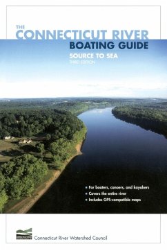
Connecticut River Boating Guide
20,99 €
inkl. MwSt.
Versandfertig in 1-2 Wochen

10 °P sammeln
Connecticut River Watershed Council
Connecticut River Boating Guide
- Broschiertes Buch
- Merkliste
- Auf die Merkliste
- Bewerten Bewerten
- Teilen
- Produkt teilen
- Produkterinnerung
- Produkterinnerung
The authoritative guide to the Connecticut River for boaters, canoeists, and kayakers.
Andere Kunden interessierten sich auch für
![Paddling Connecticut and Rhode Island Paddling Connecticut and Rhode Island]() Jim ColePaddling Connecticut and Rhode Island17,99 €
Jim ColePaddling Connecticut and Rhode Island17,99 €![The Seven Seat The Seven Seat]() Daniel J. BoyneThe Seven Seat26,99 €
Daniel J. BoyneThe Seven Seat26,99 €![Canal Locks - No Problem Canal Locks - No Problem]() Thomas VeberCanal Locks - No Problem10,99 €
Thomas VeberCanal Locks - No Problem10,99 €![A Guide to the Design and Handling of Dinghies - A Collection of Historical Boating Articles on Sailing, Rowing and Construction of Dinghies A Guide to the Design and Handling of Dinghies - A Collection of Historical Boating Articles on Sailing, Rowing and Construction of Dinghies]() VariousA Guide to the Design and Handling of Dinghies - A Collection of Historical Boating Articles on Sailing, Rowing and Construction of Dinghies33,99 €
VariousA Guide to the Design and Handling of Dinghies - A Collection of Historical Boating Articles on Sailing, Rowing and Construction of Dinghies33,99 €![A Guide to Small Boat Handling - A Collection of Historical Boating Articles on the Basics of Handling Rowing Boats and Motor Boats A Guide to Small Boat Handling - A Collection of Historical Boating Articles on the Basics of Handling Rowing Boats and Motor Boats]() VariousA Guide to Small Boat Handling - A Collection of Historical Boating Articles on the Basics of Handling Rowing Boats and Motor Boats30,99 €
VariousA Guide to Small Boat Handling - A Collection of Historical Boating Articles on the Basics of Handling Rowing Boats and Motor Boats30,99 €![A Yachtsman's Guide to Tides - A Collection of Historical Boating Articles on How to Read Tides and Currents A Yachtsman's Guide to Tides - A Collection of Historical Boating Articles on How to Read Tides and Currents]() VariousA Yachtsman's Guide to Tides - A Collection of Historical Boating Articles on How to Read Tides and Currents27,99 €
VariousA Yachtsman's Guide to Tides - A Collection of Historical Boating Articles on How to Read Tides and Currents27,99 €![A Yachtsman's Guide to Boat Accommodation - A Collection of Historical Boating Articles on the Construction and Comforts of Living Quarters A Yachtsman's Guide to Boat Accommodation - A Collection of Historical Boating Articles on the Construction and Comforts of Living Quarters]() VariousA Yachtsman's Guide to Boat Accommodation - A Collection of Historical Boating Articles on the Construction and Comforts of Living Quarters29,99 €
VariousA Yachtsman's Guide to Boat Accommodation - A Collection of Historical Boating Articles on the Construction and Comforts of Living Quarters29,99 €-
-
-
The authoritative guide to the Connecticut River for boaters, canoeists, and kayakers.
Hinweis: Dieser Artikel kann nur an eine deutsche Lieferadresse ausgeliefert werden.
Hinweis: Dieser Artikel kann nur an eine deutsche Lieferadresse ausgeliefert werden.
Produktdetails
- Produktdetails
- Verlag: FALCON GUIDES
- Third Edition
- Seitenzahl: 258
- Erscheinungstermin: 27. März 2017
- Englisch
- Abmessung: 229mm x 152mm x 14mm
- Gewicht: 379g
- ISBN-13: 9780762740970
- ISBN-10: 0762740973
- Artikelnr.: 22542825
- Herstellerkennzeichnung
- Libri GmbH
- Europaallee 1
- 36244 Bad Hersfeld
- gpsr@libri.de
Founded in 1952, the Connecticut River Watershed Council, with headquarters in Greenfield, Massachusetts, is the river's primary watchdog and steward "from source to sea."
Acknowledgments Preface IntroductionAuthors' Welcome to the RiverHow to Use
This GuideBoating Safety The RiverMap of Connecticut River WatershedThe
Four Geographic Regions of the Connecticut River ValleyGeology: Grand
Events in the Making of a Great RiverRiver Dynamics and Natural Plant
CommunitiesConnecticut River FisheriesA Connecticut River Valley
HistoryAnimals Large and Small Vermont and New HampshireOverview Map of
Vermont and New Hampshire1. Fourth Connecticut Lake to Murphy Dam2. Murphy
Dam to Canaan Dam3. Canaan Dam to Colebrook4. Colebrook to Bloomfield-North
Stratford5. Bloomfield-North Stratford to Guildhall6. Guildhall to Gilman
Dam7. Gilman Dam to Comerford Dam8. Comerford Dam to Woodsville9.
Woodsville to Haverhill10. Haverhill to Orford11. Orford to Ompompanoosuc
River12. Ompompanoosuc River to Wilder Dam13. Wilder Dam to Cornish-Windsor
Bridge14. Cornish-Windsor Bridge to Cheshire Bridge15. Cheshire Bridge to
Bellows Falls-North Walpole16. Bellows Falls-North Walpole to Putney17.
Putney to Vernon Dam MassachusettsOverview Map of Massachusetts18. Vernon
Dam to Turners Falls Dam19. Turners Falls Dam to Sunderland20. Sunderland
to Northampton21. Northhampton to Holyoke Dam22. Holyoke Dam to Enfield
ConnecticutOverview Map of Connecticut23. Enfield to Hartford24. Hartford
to Middletown25. Middletown to East Haddam26. East Haddam-Chester to
Essex27. Essex to the Sound (Western Shore)28. Lyme to the Sound (Eastern
Shore) Appendix A: BibliographyAppendix B: Useful Web Sites and Contact
InformationAppendix C: Marinas, Outfitters, and GuidesAppendix D: The
Connecticut River Watershed CouncilIndexAbout the Authors
