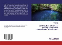
Contribution of remote sensing to estimate groundwater withdrawals
Versandkostenfrei!
Versandfertig in 6-10 Tagen
27,99 €
inkl. MwSt.

PAYBACK Punkte
14 °P sammeln!
The present report shows the contribution of remote sensing to estimate the volume of water withdrawn from aquifers, for a semi-arid or arid climate, such as that in our study area: the Aquifer System of Spatientrional Sahara. The vegetation area was firstly estimated from a spatial distribution of vegetation indices from the MOD13Q1 product of the MODIS sensor for a period from 2001 to 2011, by an algorithm highlighting the pixels in the red and the infrared. It's, on average, almost constant at 500 km2 for all the years. Furthermore, evapotranspiration was defined spatially and statistically...
The present report shows the contribution of remote sensing to estimate the volume of water withdrawn from aquifers, for a semi-arid or arid climate, such as that in our study area: the Aquifer System of Spatientrional Sahara. The vegetation area was firstly estimated from a spatial distribution of vegetation indices from the MOD13Q1 product of the MODIS sensor for a period from 2001 to 2011, by an algorithm highlighting the pixels in the red and the infrared. It's, on average, almost constant at 500 km2 for all the years. Furthermore, evapotranspiration was defined spatially and statistically by the MOD16A2 product, on the whole basin for 2011. The statistics are derived from an algorithm ensuring the logic based on the Penman-Monteith equation. These statistics regarding the area of vegetation gave the annual total volume of withdrawn water because this volume is evaporated in the absence of rainfall in the water balance and the depth of the basin does not allow it to vary in the ground's level. There was extraction more than 2,5 billion meters-cube. This means that the enormity of the consumption that is, indeed, a few hundred m3/s.


