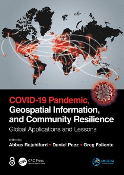
COVID-19 Pandemic, Geospatial Information, and Community Resilience
Global Applications and Lessons
Herausgeber: Rajabifard, Abbas; Foliente, Greg; Paez, Daniel
COVID-19 Pandemic, Geospatial Information, and Community Resilience
Global Applications and Lessons
Herausgeber: Rajabifard, Abbas; Foliente, Greg; Paez, Daniel
- Gebundenes Buch
- Merkliste
- Auf die Merkliste
- Bewerten Bewerten
- Teilen
- Produkt teilen
- Produkterinnerung
- Produkterinnerung
"The Open Access version of this book, available at https://www.taylorfrancis.com/books/oa-edit/10.1201/9781003181590, has been made available under a Creative Commons Attribution-Non Commercial-No Derivatives 4.0 license." Geospatial information plays an important role in managing location dependent pandemic situations across different communities and domains. Geospatial information and technologies are particularly critical to strengthening urban and rural resilience, where economic, agricultural, and various social sectors all intersect. Examining the United Nations' SDGs from a geospatial…mehr
Andere Kunden interessierten sich auch für
![COVID-19 Pandemic COVID-19 Pandemic]() COVID-19 Pandemic121,99 €
COVID-19 Pandemic121,99 €![COVID-19 Pandemic COVID-19 Pandemic]() COVID-19 Pandemic121,99 €
COVID-19 Pandemic121,99 €![COVID-19 and Water in Asia and the Pacific COVID-19 and Water in Asia and the Pacific]() Asian Development BankCOVID-19 and Water in Asia and the Pacific45,99 €
Asian Development BankCOVID-19 and Water in Asia and the Pacific45,99 €![COVID-19 and the Environment COVID-19 and the Environment]() Austin MardonCOVID-19 and the Environment28,99 €
Austin MardonCOVID-19 and the Environment28,99 €![COVID-19 COVID-19]() Chris DayCOVID-1934,99 €
Chris DayCOVID-1934,99 €![Computerized Systems for Diagnosis and Treatment of COVID-19 Computerized Systems for Diagnosis and Treatment of COVID-19]() Computerized Systems for Diagnosis and Treatment of COVID-19142,99 €
Computerized Systems for Diagnosis and Treatment of COVID-19142,99 €![Sztuczna Inteligencja i COVID-19 Sztuczna Inteligencja i COVID-19]() AbdelrahmanSztuczna Inteligencja i COVID-1920,99 €
AbdelrahmanSztuczna Inteligencja i COVID-1920,99 €-
-
-
"The Open Access version of this book, available at https://www.taylorfrancis.com/books/oa-edit/10.1201/9781003181590, has been made available under a Creative Commons Attribution-Non Commercial-No Derivatives 4.0 license." Geospatial information plays an important role in managing location dependent pandemic situations across different communities and domains. Geospatial information and technologies are particularly critical to strengthening urban and rural resilience, where economic, agricultural, and various social sectors all intersect. Examining the United Nations' SDGs from a geospatial lens will ensure that the challenges are addressed for all populations in different locations. This book, with worldwide contributions focused on COVID-19 pandemic, provides interdisciplinary analysis and multi-sectoral expertise on the use of geospatial information and location intelligence to support community resilience and authorities to manage pandemics.
Hinweis: Dieser Artikel kann nur an eine deutsche Lieferadresse ausgeliefert werden.
Hinweis: Dieser Artikel kann nur an eine deutsche Lieferadresse ausgeliefert werden.
Produktdetails
- Produktdetails
- Verlag: CRC Press
- Seitenzahl: 560
- Erscheinungstermin: 28. Juni 2021
- Englisch
- Abmessung: 260mm x 183mm x 34mm
- Gewicht: 1235g
- ISBN-13: 9780367775315
- ISBN-10: 036777531X
- Artikelnr.: 62185448
- Herstellerkennzeichnung
- Libri GmbH
- Europaallee 1
- 36244 Bad Hersfeld
- gpsr@libri.de
- Verlag: CRC Press
- Seitenzahl: 560
- Erscheinungstermin: 28. Juni 2021
- Englisch
- Abmessung: 260mm x 183mm x 34mm
- Gewicht: 1235g
- ISBN-13: 9780367775315
- ISBN-10: 036777531X
- Artikelnr.: 62185448
- Herstellerkennzeichnung
- Libri GmbH
- Europaallee 1
- 36244 Bad Hersfeld
- gpsr@libri.de
Professor Abbas Rajabifard is an internationally recognised scholar and geospatial engineer. He is an active leader in land administration modernisation and geospatial enablement and disaster resilience, and his passion is in the field of research and innovation to serve global community. He is Director of Smart and Sustainable Development and Academic Lead Infrastructure platform in the Faculty of Engineering and IT at The University of Melbourne. He is a member of International Advisory Board and former Chair UN-GGIM Academic Network. He is also Director of the Centre for Spatial Data Infrastructures & Land Administration (CSDILA). From 2013 to 2020 he was the Director of Centre for Disaster Management and Public Safety at the University of Melbourne. Prof. Rajabifard has active research in the areas of digital twin, sustainability and resilience, location intelligence, SDI, land administration modernisation, urban analytics, spatial enabled government and societies, disaster management, 3D visualisation and urban analytics, and SDGs.
Part I: Setting the Scene. The Role and Value of Geospatial Information and
Technology in a Pandemic. Part II: Technical and Techno-Social Solutions.
Land Administration and Authoritative Geospatial Information: Lessons from
Disasters to Support Building Resilience to Pandemics. Open Geospatial Data
for Responding to the COVID-19 Challenge. Remote Sensing and Computational
Epidemiology. The Potential of Drone Technology in Pandemics. The Role of
Neighborhood Social and Built Environments on Social Interactions and
Community Wellbeing Through the COVID-19 Pandemic. Social Vulnerability to
COVID-19: Preliminary Indicators and Research Agenda. Informal Road
Detection and Uncertainty in Remote Sensing. Management and Analysis of
Maritime Geospatial Data During COVID-19: Case Studies, Opportunities and
Challenges. City Design and the Transmission of COVID-19. Sensing Community
Resilience Using Social Media. Role of the Professional Body in a Pandemic.
OpenStreetMap Data Use Cases During the Early Months of the COVID-19
Pandemic. Utilization of Geospatial Network Analysis Technique for Optimal
Route Planning During COVID-19 Pandemic. Formalizing Informal Settlements
to Empower Residents Against COVID-19 and Other Disasters. Spatially
Enabled COVID-19: A Review of Applications and Systems. COVID-19
Spatiotemporal Hotspots and Prediction Based on Wavelet and Neural Network.
Part III: Regional, Country and Local Applications. London in Lockdown:
Mobility in the Pandemic City. Americas' Geospatial Response to COVID-19.
Temporal Information Management to Control the COVID-19 Epidemic: Country
Perspectives in Europe. Practicing Online Higher Education Facilitated by
ICT In China: In The Context Of COVID-19 Pandemic. Time-Series Analysis of
COVID-19 in Iran: A Remote Sensing Perspective. "Creating a Set of
High-Resolution Vulnerability Indicators to Support the Disaster Management
Response to the COVID-19 Pandemic in South Africa". Rapid Development of
Location-based Apps: Saving Lives during a Pandemic - the South Korean
Experience. Spatial Analysis of Urban Parks and COVID-19: City of
Whittlesea, Victoria, Australia. The Economic Impact of COVID-19 in Pacific
Island Countries and Territories. Promoting Resilience While Mitigating
Disease Transmission: An Australian COVID-19 Study. Impacts of COVID-19
lockdown restrictions on housing and public space use and adaptation: Urban
proximity, public health, and vulnerability in three Latin American cities.
Use of Geospatial Information and Technologies in Understanding the
COVID-19 Pandemic in Canada: Examples and Critical Discussion. Geospatial
Intelligence in Dealing with COVID-19 Challenges in Czechia. COVID-19 in
France: A Multiphase and Multidimensional Approach to a Complex Societal
Imbalance. Part IV: Stakeholder Perspectives. Digital Earth: A World
Infrastructure for Sustaining Resilience in Complex Pandemic Scenarios.
COVID-19: The Open Data Pandemic. The Challenge of Mapping COVID-19 Data.
Better Engagement to Build Smarter, Resilient Communities. How the
Coronavirus Could Change Urban Planning. Toward Agile Strategies for
Enhancing Community Resilience Following the COVID-19 Pandemic: An
Interview Study. COVID-19 Pandemic in Finland: Converting a Forced
Digitalisation into an Opportunity. What's the Future of Greek Cities in
the Post-COVID-19 Period? New Perspectives on Urban Resilience and
Sustainable Mobility. COVID-19 Pandemic Challenges and Impacts on the SDGs
2030: Indian Perspective. The Value of a Policy-Responsive Research Funding
Model: The Geohealth Laboratory Collaboration in New Zealand. Pandemic and
the City: A Melbourne Perspective for Community Resilience. Spatial
Modelling Concepts for Controlling COVID-19 Risk in Saudi Arabia. COVID-19
in Spain and the Use of Geospatial Information. Lessons Learned from
COVIDSafe: Understanding Conditions for Successful Implementation of Track
and Trace Technologies. Sustainable Transport as a Key Pillar to Community
Resilience During the COVID-19 Pandemic. Part V: The Future Direction.
Preparing for the next pandemic: Geospatial information for enhanced
community resilience.

