Jeffrey P Schaffer
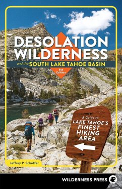
Desolation Wilderness and the South Lake Tahoe Basin
A Guide to Lake Tahoe's Finest Hiking Area
18,99 €
inkl. MwSt.
Versandfertig in über 4 Wochen

9 °P sammeln
Jeffrey P Schaffer
Desolation Wilderness and the South Lake Tahoe Basin
A Guide to Lake Tahoe's Finest Hiking Area
- Broschiertes Buch
- Merkliste
- Auf die Merkliste
- Bewerten Bewerten
- Teilen
- Produkt teilen
- Produkterinnerung
- Produkterinnerung
This comprehensive guidebook spotlights 32 of the best hiking trails in Desolation Wilderness and the surrounding areas.
Andere Kunden interessierten sich auch für
![Five-Star Trails: Lake Tahoe Five-Star Trails: Lake Tahoe]() Jordan SummersFive-Star Trails: Lake Tahoe14,99 €
Jordan SummersFive-Star Trails: Lake Tahoe14,99 €![Trails of the Angeles Trails of the Angeles]() David HarrisTrails of the Angeles19,99 €
David HarrisTrails of the Angeles19,99 €![Hiking & Backpacking Santa Barbara & Ventura Hiking & Backpacking Santa Barbara & Ventura]() Craig R CareyHiking & Backpacking Santa Barbara & Ventura22,99 €
Craig R CareyHiking & Backpacking Santa Barbara & Ventura22,99 €![Top Trails: Olympic National Park and Vicinity Top Trails: Olympic National Park and Vicinity]() Douglas LorainTop Trails: Olympic National Park and Vicinity15,99 €
Douglas LorainTop Trails: Olympic National Park and Vicinity15,99 €![Backpacking Oregon Backpacking Oregon]() Douglas LorainBackpacking Oregon18,99 €
Douglas LorainBackpacking Oregon18,99 €![101 Hikes in Southern California 101 Hikes in Southern California]() David Harris101 Hikes in Southern California22,99 €
David Harris101 Hikes in Southern California22,99 €![Pacific Crest Trail: Northern California Pacific Crest Trail: Northern California]() Jordan SummersPacific Crest Trail: Northern California26,99 €
Jordan SummersPacific Crest Trail: Northern California26,99 €-
-
-
This comprehensive guidebook spotlights 32 of the best hiking trails in Desolation Wilderness and the surrounding areas.
Hinweis: Dieser Artikel kann nur an eine deutsche Lieferadresse ausgeliefert werden.
Hinweis: Dieser Artikel kann nur an eine deutsche Lieferadresse ausgeliefert werden.
Produktdetails
- Produktdetails
- Verlag: Wilderness Press
- 5th Revised edition
- Seitenzahl: 184
- Erscheinungstermin: 20. April 2021
- Englisch
- Abmessung: 213mm x 137mm x 13mm
- Gewicht: 227g
- ISBN-13: 9781643590653
- ISBN-10: 1643590650
- Artikelnr.: 60156123
- Herstellerkennzeichnung
- Libri GmbH
- Europaallee 1
- 36244 Bad Hersfeld
- gpsr@libri.de
Jeffrey P. Schaffer made his first backpacking trip in a 1962 traverse of the Grand Canyon, at age 19. The following year the climbing frenzy seized him, which lasted until about 1972, some 200 roped ascents later. In that year he began working on his first book for Wilderness Press, The Pacific Crest Trail. Between then and the late 1980s, he was the sole or principal author of 12 guidebooks, and he had mapped about 4,000 miles of trail for his books and topographic maps. Innumerable observations while hiking made him question conventional geological wisdom on the origin of mountain ranges, which led him to write a lengthy book on the origin of the Sierra Nevada landscapes, particularly Yosemite Valley. At the start of the millennium he was teaching geology and geography at Napa Valley College, introducing students to the Sierra Nevada and other lands. Wilderness Press books authored or coauthored by Jeff include Hiker's Guide to the High Sierra: Yosemite and Tuolumne Meadows, Pacific Crest Trail: Southern California, Pacific Crest Trail: Northern California, The Pacific Crest Trail, Vol. 2: Oregon and Washington, Lassen Volcanic National Park and Vicinity, Yosemite National Park, Desolation Wilderness and the South Lake Tahoe Basin, The Tahoe Sierra, Hiking the Big Sur Country: The Ventana Wilderness, and The Geomorphic Evolution of the Yosemite Valley and Sierra Nevada Landscapes.
Chapter 1: The Country
Chapter 2: Hiking in the Tahoe Area
Chapter 3: Natural History of the Tahoe Area
Chapter 4: Thirty-Two Hikes
1. Desolation Wilderness, West Side
* Hike 1: Loon Lake Trail
* Hike 2: Lyons Creek Trail
* Hike 3: Bloodsucker Lake Trail
* Hike 4: Barrett Lake and Red Peak Trails
* Hike 5: Twin Lakes and Grouse Lake Trails
* Hike 6: Tyler Lake Trail
* Hike 7: Rockbound Pass Trail
* Hike 8: Horsetail Falls Trail
* Hike 9: Ralston Peak Trail
2. Desolation Wilderness, Center
* Hike 10: Pacific Crest Trail to Lake Aloha
* Hike 11: Pacific Crest Trail to McKinney Creek OHV Staging Area
3. Desolation Wilderness, Southeast Side
* Hike 12: Angora Fire Lookout and Angora Lakes
* Hike 13: Tamarack Trail to Echo Peak
* Hike 14: Grass Lake
* Hike 15: Glen Alpine to Lake Aloha
* Hike 16: Half Moon and Alta Morris Lakes
* Hike 17: Mt. Tallac via Gilmore Lake
* Hike 18: Mt. Tallac via Floating Island Lake
* Hike 19: Granite Lake and Cascade Creek Fall
* Hike 20: Velma Lakes Area
4. Emerald Bay
* Hike 21: Emerald Bay State Park
* Hike 22: D. L. Bliss State Park
5. Desolation Wilderness, Northeast Side and Sugar Pine Point State Park
* Hike 23: Tahoe-Yosemite Trail to Middle Velma Lake
* Hike 24: General Creek Trail
6. South Fork American River
* Hike 25: Lovers Leap
* Hike 26: Sayles Canyon and Bryan Meadow
* Hike 27: Echo Summit to Showers Lake
7. Upper Truckee River
* Hike 28: Hawley Grade Trail
* Hike 29: Meiss Meadow Trail to Dardanelles Lake
* Hike 30: Big Meadow Trail to Round Lake
* Hike 31: Carson Pass to Showers Lake
* Hike 32: Schneider's Cow Camp to Showers and Meiss Lakes
Chapter 5: Maps for Desolation Wilderness and Adjoining Areas
Recommended Reading and Source Materials
Index
Map Index
