26,99 €
inkl. MwSt.
Versandkostenfrei*
Versandfertig in 1-2 Wochen
payback
13 °P sammeln
  • Broschiertes Buch

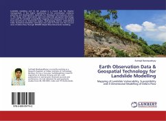
Landslide modeling and its risk analysis is a crucial task for disaster management. It has higher significance in the post-disaster resilience planning and development, especially for Himalayan mountainous terrain. In this study, earth observation data and advanced geospatial technology were used for landslide susceptibility mapping and subsequent risk analysis from Gourikund to Kedarnath region, Rudraprayag District, Uttarakhand India. Numerical simulation technique was used to frame out the run-out zone of debris flow through RAMMS (Rapid Mass Movement) modeling.

Produktbeschreibung
Landslide modeling and its risk analysis is a crucial task for disaster management. It has higher significance in the post-disaster resilience planning and development, especially for Himalayan mountainous terrain. In this study, earth observation data and advanced geospatial technology were used for landslide susceptibility mapping and subsequent risk analysis from Gourikund to Kedarnath region, Rudraprayag District, Uttarakhand India. Numerical simulation technique was used to frame out the run-out zone of debris flow through RAMMS (Rapid Mass Movement) modeling.
Hinweis: Dieser Artikel kann nur an eine deutsche Lieferadresse ausgeliefert werden.
Autorenporträt
Subhajit Bandopadhyay is currently working as a Research Assistant at Indian Institute of Technology Bombay. He has a two-year multidisciplinary research experience in Remote Sensing and GIS, with publications in several peer-reviewed journals and conferences. He had obtained his post-graduate studies from VB, IIRS-ISRO, India and ITC-Netherlands.