32,99 €
inkl. MwSt.
Versandkostenfrei*
Versandfertig in 6-10 Tagen
  • Broschiertes Buch

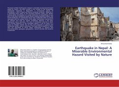
Among the different natural hazards, the loss and damage by earthquake is extremely high in terms of life and property. Nepal lies in one of the high risk earthquake zone in the world. Therefore, the present research aimed for indepth analysis of the status of Inaruwa Municipality that lies in eastern Tarai of Nepal. It uses different tools and techniques of GIS with RADIUS method for the related analysis and mapping. Mainly, this study helps in estimation of the vulnerability of buildings and human casualties under different probable earthquake scenarios. It also explores the indigenous…mehr

Produktbeschreibung
Among the different natural hazards, the loss and damage by earthquake is extremely high in terms of life and property. Nepal lies in one of the high risk earthquake zone in the world. Therefore, the present research aimed for indepth analysis of the status of Inaruwa Municipality that lies in eastern Tarai of Nepal. It uses different tools and techniques of GIS with RADIUS method for the related analysis and mapping. Mainly, this study helps in estimation of the vulnerability of buildings and human casualties under different probable earthquake scenarios. It also explores the indigenous technical knowledge and awareness of the local people regarding the earthquake hazard.
Autorenporträt
Raju Rai holds Master Degree in Geography (M.A.) from Tribhuwan University in 2007. He has also completed Bachelor Degree in Education (B.Ed.) from T.U., Nepal. He has more than 6 years experiences in research works as a GIS expert, Geographer, Researcher in various research projects in government and non-government offices.