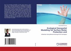
Due to the preceding vulnerability of surface water resources in Sierra Leone, there is a growing concern about it Availability and sustainability. Among many of the factors leading to the vulnerability are population growth, pollution, deforestation, catchment encroachment, unsustainable land uses, climate change etc. The study focuses on the use of Remote Sensing and GIS for the protection and utilization of surface water, thereby building a model for ecological stressors. It is cascaded into coarse and fine scale research studies. The coarse-scale study looks at the country level (Sierra Leone) surface water resources. In that data which include Waterbodies (Rivers, streams, etc.), roads, settlements (major and minor), and Digital Elevation Models (DEM) are used. Using these data, the densities of water bodies, roads, settlements and drainage could be computed in a GIS environment. In order to be able to know the ecological relationship of each to surface water, these variables are normalized and integrated in the ENVI software. It is found that, roads and settlements have a negative relationship to surface water bodies, and hence the higher the densities.
Bitte wählen Sie Ihr Anliegen aus.
Rechnungen
Retourenschein anfordern
Bestellstatus
Storno

