39,99 €
inkl. MwSt.
Versandkostenfrei*
Versandfertig in 1-2 Wochen
payback
20 °P sammeln
  • Broschiertes Buch

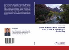
This study assessed the effect of digital elevation model (DEM) resolution along with rainfall intensity and storm size on modeling hydrologic processes at plot and subwatershed scales in the Walnut Gulch Experimental Watershed in SE Arizona. At the plot scale, ground based LiDAR data were used to generate 1 cm resolution Digital Surface models (DSM). A vegetation removal method was developed which used a slope threshold and a focal mean filter to remove vegetation to create the DEMs. Validation of the method showed an error of ± 7 mm. KINEROS2, was used to model the hydrologic processes at…mehr

Produktbeschreibung
This study assessed the effect of digital elevation model (DEM) resolution along with rainfall intensity and storm size on modeling hydrologic processes at plot and subwatershed scales in the Walnut Gulch Experimental Watershed in SE Arizona. At the plot scale, ground based LiDAR data were used to generate 1 cm resolution Digital Surface models (DSM). A vegetation removal method was developed which used a slope threshold and a focal mean filter to remove vegetation to create the DEMs. Validation of the method showed an error of ± 7 mm. KINEROS2, was used to model the hydrologic processes at both plot and subwatershed scales. In this study, a 10 m resolution DEM was high enough resolution to model the surface runoff processes at the subwatershed scale, while at the plot scale 5 cm resolution was high enough to model the surface runoff processes
Hinweis: Dieser Artikel kann nur an eine deutsche Lieferadresse ausgeliefert werden.
Autorenporträt
Maneesh Sharma earned his PhD from Center of Advanced Studies in Geology in India and then took German Academic Exchange Post doctoral fellowship at University of Erlangen-Nuremeberg, Germany. He is presently GIS Project Lead at West Virginia GIS Technical Center, West Virginia University, Morgantown, West Virginia, USA