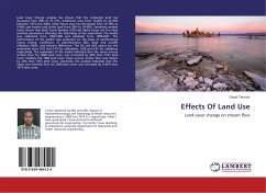
Effects Of Land Use
Land cover change on stream flow
Versandkostenfrei!
Versandfertig in 6-10 Tagen
27,99 €
inkl. MwSt.

PAYBACK Punkte
14 °P sammeln!
Land cover change analysis has shown that the cultivated land has increased from 28% to 31.21%, settlement area from 16.26% to 22.35% between 1973 and 2000, while forest area has decreased from 16.78% to 9.48% and bushes and shrub land from 36% to 34.96%. Sensitivity analysis result shown that both Curve Number (CN) and Alpha factor are the most sensitive parameters affecting the hydrology of the watershed. The model was calibrated from 1993-1998 and validated from 1999-2001. The performance of the model was evaluated on the basis of performance rating criteria, coefficient of determination (R...
Land cover change analysis has shown that the cultivated land has increased from 28% to 31.21%, settlement area from 16.26% to 22.35% between 1973 and 2000, while forest area has decreased from 16.78% to 9.48% and bushes and shrub land from 36% to 34.96%. Sensitivity analysis result shown that both Curve Number (CN) and Alpha factor are the most sensitive parameters affecting the hydrology of the watershed. The model was calibrated from 1993-1998 and validated from 1999-2001. The performance of the model was evaluated on the basis of performance rating criteria, coefficient of determination (R2), Nash and Sutcliff efficiency (NSE), and percent difference. The R2 and NSE values for the watershed were 0.87 and 0.79 for calibration, 0.89 and 0.81 for validation respectively. The evaluation of the model indicated that the mean annual surface flow for 2000 land cover was increased by 46% than 1973 land cover. Similarly the 1986 land cover mean annual surface flow was higher by 20% than 1973 land cover. Generally, the analysis indicated that the mean wet monthly flow for 2000 land cover was increased by 9.43% than 1973 land cover.


