44,99 €
inkl. MwSt.
Versandkostenfrei*
Versandfertig in 6-10 Tagen
  • Broschiertes Buch

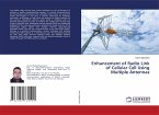
Satellite images are one of the most powerful and important tools we have for monitoring the Earth. In this research, various satellite image processing algorithms are implemented for dimensional reduction techniques and enhancement of the details of satellite image local objects.The main intensity of this work is to study NOAA satellite images and apply preprocessing algorithms and classification can be done on cloud data after dimensionality reduction techniques.

Produktbeschreibung
Satellite images are one of the most powerful and important tools we have for monitoring the Earth. In this research, various satellite image processing algorithms are implemented for dimensional reduction techniques and enhancement of the details of satellite image local objects.The main intensity of this work is to study NOAA satellite images and apply preprocessing algorithms and classification can be done on cloud data after dimensionality reduction techniques.
Autorenporträt
Dr. T. Venkatakrishna Moorthy and Dr. G. Umamaheswara Reddy - Department of Electronics and Communication Engineering, Sri Venkateswara University, College Of Engineering.