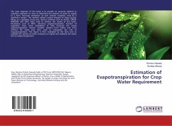
Estimation of Evapotranspiration for Crop Water Requirement
Versandkostenfrei!
Versandfertig in 6-10 Tagen
24,99 €
inkl. MwSt.

PAYBACK Punkte
12 °P sammeln!
The main objective of this book is to provide an accurate method to irrigation engineers on how to determine the amount of water to supply to a farm. Accurate estimation of such reduces irrigation costs by a significant margin. The method utilizes Landsat Imagery of Siaya County, Kenya as a specimen study area. Various software such as ArcGIS, ERDAS IMAGINE and ENVI were used to achieve the results of this book. Parameters such as NDVI, reference evapotranspiration, fraction of vegetative cover were established to help compute the actual evapotranspiration. Various weather stations from within...
The main objective of this book is to provide an accurate method to irrigation engineers on how to determine the amount of water to supply to a farm. Accurate estimation of such reduces irrigation costs by a significant margin. The method utilizes Landsat Imagery of Siaya County, Kenya as a specimen study area. Various software such as ArcGIS, ERDAS IMAGINE and ENVI were used to achieve the results of this book. Parameters such as NDVI, reference evapotranspiration, fraction of vegetative cover were established to help compute the actual evapotranspiration. Various weather stations from within and from without the study area were used to interpolate the rate of evapotranspiration. This figure is then multiplied by the farm area to establish the volume of water necessary to irrigate and replenish the water lost via evapotranspiration.


