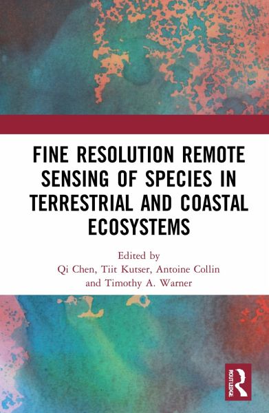
Detailed and accurate information on the spatial distribution of individual species over large spatial extents and over multiple time periods is critical for rapid response and e¿ective management of environmental change. The twenty first century has witnessed a rapid development in both ¿ne resolution sensors and statistical theories and techniques. These innovations hold great potential for improved accuracy of species mapping using remote sensing. Fine Resolution Remote Sensing of Species in Terrestrial and Coastal Ecosystems is a collection of eight cutting-edge studies of ¿ne spatial…mehr
Detailed and accurate information on the spatial distribution of individual species over large spatial extents and over multiple time periods is critical for rapid response and e¿ective management of environmental change. The twenty first century has witnessed a rapid development in both ¿ne resolution sensors and statistical theories and techniques. These innovations hold great potential for improved accuracy of species mapping using remote sensing. Fine Resolution Remote Sensing of Species in Terrestrial and Coastal Ecosystems is a collection of eight cutting-edge studies of ¿ne spatial resolution remote sensing, including species mapping of biogenic and coral reefs, seagrasses, salt and freshwater marshes, and grasslands. The studies illustrate the power of fine resolution imagery for species identi¿cation, as well as the value of unmanned aerial vehicle (UAV) imagery as an ideal source of high-quality reference data at the species level. The studies also highlight the benefit of LiDAR (Light Detection and Ranging) data for species identi¿cation, and how this varies depending on the species of interest as well as the nature of the context in which the species is found. The broad range of applications explored in the book demonstrates the major contribution of remote sensing to species-level terrestrial and coastal ecosystem studies as well as the potential for future advances. The chapters in this book were originally published as a special issue of the International Journal of Remote Sensing.Hinweis: Dieser Artikel kann nur an eine deutsche Lieferadresse ausgeliefert werden.
Qi Chen is Professor of Geography and Environment at the University of Hawai¿i at M¿noa, Honolulu, USA. His research focuses on the use of LiDAR, high spatial resolution remote sensing, statistical modelling, and artificial intelligence for environmental mapping and monitoring. Tiit Kutser is Professor of Remote Sensing at the Estonian Marine Institute, University of Tartu, Tallinn, Estonia. His research covers many different topics from mapping water quality parameters (including harmful algal blooms) in coastal and inland waters to benthic habitat (including coral reefs) mapping and the role of lakes in the global carbon cycle. Antoine Collin is Associate Professor of Geography and Ecology at the Paris Sciences & Letters (PSL) University, Dinard, France. His research links the coastal natural and social sciences in the ocean-climate change. He maps and models costal environments using high spatio-temporal resolution spaceborne, airborne, handborne, waterborne data, and machine learning. Timothy A. Warner is Emeritus Professor of Geology and Geography at West Virginia University, Morgantown, USA. He served as editor in chief of the International Journal of Remote Sensing from 2014 to 2020. He is a Fellow of the American Society of Photogrammetry and Remote Sensing.
Inhaltsangabe
Introduction: Fine resolution remote sensing of species in terrestrial and coastal ecosystems Qi Chen Tiit Kutser Antoine Collin and Timothy A. Warner 1. Mapping freshwater marsh species in the wetlands of Lake Okeechobee using very high-resolution aerial photography and lidar data Caiyun Zhang Sara Denka and Deepak R. Mishra 2. Satellite-based salt marsh elevation vegetation height and species composition mapping using the superspectral WorldView-3 imagery Antoine Collin Natasha Lambert and Samuel Etienne 3. Mapping semi-natural grassland communities using multi-temporal RapidEye remote sensing data Christoph Raab H. G. Stroh B. Tonn M. Meißner N. Rohwer N. Balkenhol and J. Isselstein 4. Very high-resolution mapping of emerging biogenic reefs using airborne optical imagery and neural network: the honeycomb worm (Sabellaria alveolata) case study Antoine Collin Stanislas Dubois Camille Ramambason and Samuel Etienne 5. Very high resolution mapping of coral reef state using airborne bathymetric LiDAR surface-intensity and drone imagery Antoine Collin Camille Ramambason Yves Pastol Elisa Casella Alessio Rovere Lauric Thiault Benoît Espiau Gilles Siu Franck Lerouvreur Nao Nakamura James L. Hench Russell J. Schmitt Sally J. Holbrook Matthias Troyer and Neil Davies 6. A comparison of airborne hyperspectral-based classifications of emergent wetland vegetation at Lake Balaton Hungary Dimitris Stratoulias Heiko Balzter András Zlinszky and Viktor R. Tóth 7. Predicting macroalgal pigments (chlorophyll a chlorophyll b chlorophyll a + b carotenoids) in various environmental conditions using high-resolution hyperspectral spectroradiometers Ele Vahtmäe Jonne Kotta Helen Orav-Kotta Ilmar Kotta Merli Pärnoja and Tiit Kutser 8. Assessment of PlanetScope images for benthic habitat and seagrass species mapping in a complex optically shallow water environment Pramaditya Wicaksono and Wahyu Lazuardi
Es gelten unsere Allgemeinen Geschäftsbedingungen: www.buecher.de/agb
Impressum
www.buecher.de ist ein Internetauftritt der buecher.de internetstores GmbH
Geschäftsführung: Monica Sawhney | Roland Kölbl | Günter Hilger
Sitz der Gesellschaft: Batheyer Straße 115 - 117, 58099 Hagen
Postanschrift: Bürgermeister-Wegele-Str. 12, 86167 Augsburg
Amtsgericht Hagen HRB 13257
Steuernummer: 321/5800/1497
USt-IdNr: DE450055826