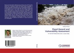
Flood Hazard and Vulnerability Assessment
In riverine flood prone area: a case study
Versandkostenfrei!
Versandfertig in 6-10 Tagen
41,99 €
inkl. MwSt.

PAYBACK Punkte
21 °P sammeln!
Flood is the major disaster affecting many countries in the world from time immemorial. The impacts of flood have been increased due to a number of factors such as population growth and climate change. Bangladesh is extremely vulnerable to flooding because of its geographical setting. It is a low-laying deltaic flat country with big inland water bodies, including some of the biggest rivers in the world. The book provides hazard and vulnerability assessment of riverine flood prone area of Bangladesh using Remote Sensing (RS) and Geographic Information System (GIS). In the hazard vulnerability a...
Flood is the major disaster affecting many countries in the world from time immemorial. The impacts of flood have been increased due to a number of factors such as population growth and climate change. Bangladesh is extremely vulnerable to flooding because of its geographical setting. It is a low-laying deltaic flat country with big inland water bodies, including some of the biggest rivers in the world. The book provides hazard and vulnerability assessment of riverine flood prone area of Bangladesh using Remote Sensing (RS) and Geographic Information System (GIS). In the hazard vulnerability assessment task, Flood frequency analysis is considered to assess flooding for different flood magnitudes. Flood inundation maps are prepared based on DEM and satellite images for different risk elements using Integrated Land and Water Information System(ILWIS) software. LANDSAT satellite images are collected to develop land use map. The land use map is used for mapping of settlement and fishery. The book mainly focuses on the development of vulnerability functions for preparing vulnerability maps for settlements and fisheries in a riverine flood prone area of Bangladesh.


