Flood Studies
Application of Microwave Radar
Versandkostenfrei!
Versandfertig in 6-10 Tagen
45,99 €
inkl. MwSt.

PAYBACK Punkte
23 °P sammeln!
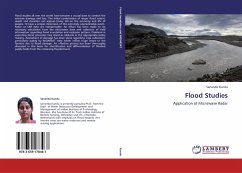
Flood studies all over the world have become a crucial base to combat the extreme damage and loss. The lethal combination of larger flood extent, depth and duration can impose heavy toll on the economy and life of people. To have a proper dimension of this extremely unpredictable event, Radar or SAR data are indispensable. An effort has been made to do necessary calculation from the microwave data and collection of field information regarding flood inundation and recession pattern. Problems in executing these processes may stand as obstacle in the appropriate policy making. Assessment of damag...
Flood studies all over the world have become a crucial base to combat the extreme damage and loss. The lethal combination of larger flood extent, depth and duration can impose heavy toll on the economy and life of people. To have a proper dimension of this extremely unpredictable event, Radar or SAR data are indispensable. An effort has been made to do necessary calculation from the microwave data and collection of field information regarding flood inundation and recession pattern. Problems in executing these processes may stand as obstacle in the appropriate policy making. Assessment of damage has been done regarding crop cultivation, particularly paddy by RADARSAT data which inflicts huge losses to the farmers due to flood damage. An effective process has been thoroughly discussed in this book for identification and differentiation of flooded paddy fields from the remaining flooded land.


