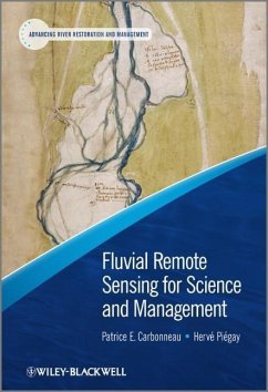
Fluvial Remote Sensing for Science and Management
Herausgegeben von Carbonneau, Patrice; Piégay, Hervé
Fluvial Remote Sensing for Science and Management
Herausgegeben von Carbonneau, Patrice; Piégay, Hervé
- Gebundenes Buch
- Merkliste
- Auf die Merkliste
- Bewerten Bewerten
- Teilen
- Produkt teilen
- Produkterinnerung
- Produkterinnerung
This book offers a comprehensive overview of progress in the general area of fluvial remote sensing with a specific focus on its potential contribution to river management. The book highlights a range of challenging issues by considering a range of spatial and temporal scales with perspectives from a variety of disciplines. The book starts with an overview of the technical progress leading to new management applications for a range of field contexts and spatial scales. Topics include colour imagery, multi-spectral and hyper-spectral imagery, video, photogrammetry and LiDAR. The book then…mehr
![Essential Image Processing and GIS for Remote Sensing Essential Image Processing and GIS for Remote Sensing]() Jian Guo LiuEssential Image Processing and GIS for Remote Sensing87,99 €
Jian Guo LiuEssential Image Processing and GIS for Remote Sensing87,99 €![Geographic Information Science Geographic Information Science]() George ChoGeographic Information Science226,99 €
George ChoGeographic Information Science226,99 €![Self-Organising Maps Self-Organising Maps]() Self-Organising Maps170,99 €
Self-Organising Maps170,99 €![Interacting with Geospatial Technologies Interacting with Geospatial Technologies]() Muki HaklayInteracting with Geospatial Technologies136,99 €
Muki HaklayInteracting with Geospatial Technologies136,99 €![Geocomputation Geocomputation]() Paul A. Longley / Sue M. Brooks / Rachael McDonnell / Bill MacMillan (Hgg.)Geocomputation101,99 €
Paul A. Longley / Sue M. Brooks / Rachael McDonnell / Bill MacMillan (Hgg.)Geocomputation101,99 €![Geographic Information Analysis Geographic Information Analysis]() David O'SullivanGeographic Information Analysis125,99 €
David O'SullivanGeographic Information Analysis125,99 €![Spatio-Temporal Approaches Spatio-Temporal Approaches]() Hélène MathianSpatio-Temporal Approaches164,99 €
Hélène MathianSpatio-Temporal Approaches164,99 €-
-
-
Key Features:
A specific focus on management applications in a period of increasing demands on managers to characterize river features and their evolution at different spatial scales
An integration across all scales of imagery with a clear discussion of both ground based and airborne images
Includes a wide-range of environmental problems
Coverage of cutting-edge technology
Contributions from leading researchers in the field
- Produktdetails
- Advancing River Restoration and Management .
- Verlag: Wiley & Sons
- 1. Auflage
- Seitenzahl: 458
- Erscheinungstermin: 4. Oktober 2012
- Englisch
- Abmessung: 249mm x 193mm x 25mm
- Gewicht: 1157g
- ISBN-13: 9780470714270
- ISBN-10: 0470714271
- Artikelnr.: 35259604
- Herstellerkennzeichnung
- Libri GmbH
- Europaallee 1
- 36244 Bad Hersfeld
- gpsr@libri.de
e Pi
egay 1.1 Introduction, 1 1.2 Remote sensing, river sciences and management, 2 1.2.1 Key concepts in remote sensing, 2 1.2.2 A short introduction to 'river friendly' sensors and platforms, 4 1.2.3 Cost considerations, 7 1.3 Evolution of published work in Fluvial Remote Sensing, 8 1.3.1 Authorships and Journals, 9 1.3.2 Platforms and Sensors, 9 1.3.3 Topical Areas, 10 1.3.4 Spatial and Temporal Resolutions, 14 1.3.5 Summary, 16 1.4 Brief outline of the volume, 16 References, 17 2 Management Applications of Optical Remote Sensing in the Active River Channel, 19 W. Andrew Marcus, Mark A. Fonstad and Carl J. Legleiter 2.1 Introduction, 19 2.2 What can be mapped with optical imagery?, 20 2.3 Flood extent and discharge, 21 2.4 Water depth, 22 2.5 Channel change, 24 2.6 Turbidity and suspended sediment, 25 2.7 Bed sediment, 27 2.8 Biotypes (in-stream habitat units), 29 2.9 Wood, 31 2.10 Submerged aquatic vegetation (SAV) and algae, 31 2.11 Evolving applications, 33 2.12 Management considerations common to river applications, 33 2.13 Accuracy, 35 2.14 Ethical considerations, 36 2.15 Why use optical remote sensing?, 36 References, 38 3 An Introduction to the Physical Basis for Deriving River Information by Optical Remote Sensing, 43 Carl J. Legleiter and Mark A. Fonstad 3.1 Introduction, 43 3.2 An overview of radiative transfer in shallow stream channels, 45 3.2.1 Quantifying the light field, 45 3.2.2 Radiative transfer processes along the image chain, 49 3.3 Optical characteristics of river channels, 54 3.3.1 Reflectance from the water surface, 55 3.3.2 Optically significant constituents of the water column, 55 3.3.3 Reflectance properties of the streambed and banks, 58 3.4 Inferring river channel attributes from remotely sensed data, 60 3.4.1 Spectrally-based bathymetric mapping via band ratios, 60 3.4.2 Relative magnitudes of the components of the at-sensor radiance signal, 61 3.4.3 The role of sensor characteristics, 62 3.5 Conclusion, 66 3.6 Notation, 67 References, 68 4 Hyperspectral Imagery in Fluvial Environments, 71 Mark J. Fonstad 4.1 Introduction, 71 4.2 The nature of hyperspectral data, 72 4.3 Advantages of hyperspectral imagery, 74 4.4 Logistical and optical limitations of hyperspectral imagery, 75 4.5 Image processing techniques, 78 4.6 Conclusions, 82 Acknowledgments, 82 References, 82 5 Thermal Infrared Remote Sensing of Water Temperature in Riverine Landscapes, 85 Rebecca N. Handcock, Christian E. Torgersen, Keith A. Cherkauer, Alan R. Gillespie, Klement Tockner, Russel N. Faux and Jing Tan 5.1 Introduction, 85 5.2 State of the art: TIR remote sensing of streams and rivers, 88 5.3 Technical background to the TIR remote sensing of water, 91 5.3.1 Remote sensing in the TIR spectrum, 91 5.3.2 The relationship between emissivity and kinetic and radiant temperature, 92 5.3.3 Using Planck's Law to determine temperature from TIR observations, 93 5.3.4 Processing of TIR image data, 94 5.3.5 Atmospheric correction, 94 5.3.6 Key points, 95 5.4 Extracting useful information from TIR images, 96 5.4.1 Calculating a representative water temperature, 96 5.4.2 Accuracy, uncertainty, and scale, 96 5.4.3 The near-bank environment, 97 5.4.4 Key points, 98 5.5 TIR imaging sensors and data sources, 98 5.5.1 Ground imaging, 98 5.5.2 Airborne imaging, 98 5.5.3 Satellite imaging, 101 5.5.4 Key points, 101 5.6 Validating TIR measurements of rivers, 102 5.6.1 Timeliness of data, 102 5.6.2 Sampling site selection, 103 5.6.3 Thermal stratification and mixing, 104 5.6.4 Measuring representative temperature, 104 5.6.5 Key points, 105 5.7 Example 1: Illustrating the necessity of matching the spatial resolution of the TIR imaging device to river width using multi-scale observations of water temperature in the Pacific Northwest (USA), 106 5.8 Example 2: Thermal heterogeneity in river floodplains used to assess habitat diversity, 108 5.9 Summary, 108 Acknowledgements, 109 5.10 Table of abbreviations, 110 References, 110 6 The Use of Radar Imagery in Riverine Flood Inundation Studies, 115 Guy J-P. Schumann, Paul. D. Bates, Giuliano Di Baldassarre and David C. Mason 6.1 Introduction, 115 6.2 Microwave imaging of water and flooded land surfaces, 116 6.2.1 Passive radiometry, 117 6.2.2 Synthetic Aperture Radar, 117 6.2.3 SAR interferometry, 119 6.3 The use of SAR imagery to map and monitor river flooding, 120 6.3.1 Mapping river flood inundation from space, 120 6.3.2 Sources of flood and water detection errors, 124 6.3.3 Integration with flood inundation modelling, 129 6.4 Case study examples, 129 6.4.1 Fuzziness in SAR flood detection to increase confidence in flood model simulations, 129 6.4.2 Near real-time flood detection in urban and rural areas using high resolution space-borne SAR images, 131 6.4.3 Multi-temporal SAR images to inform about floodplain dynamics, 133 6.5 Summary and outlook, 135 References, 137 7 Airborne LiDAR Methods Applied to Riverine Environments, 141 Jean-St
ephane Bailly, Paul J. Kinzel, Tristan Allouis, Denis Feurer and Yann Le Coarer 7.1 Introduction: LiDAR definition and history, 141 7.2 Ranging airborne LiDAR physics, 142 7.2.1 LiDAR for emergent terrestrial surfaces, 142 7.2.2 LiDAR for aquatic surfaces, 144 7.3 System parameters and capabilities: examples, 146 7.3.1 Large footprint system: HawkEye II, 146 7.3.2 Narrow footprint system: EAARL, 147 7.3.3 Airborne LiDAR capacities for fluvial monitoring: a synthesis, 148 7.4 LiDAR survey design for rivers, 148 7.4.1 Flight planning and optimising system design, 148 7.4.2 Geodetic positioning, 150 7.5 River characterisation from LiDAR signals, 150 7.5.1 Altimetry and topography, 150 7.5.2 Prospective estimations, 152 7.6 LiDAR experiments on rivers: accuracies, limitations, 153 7.6.1 LiDAR for river morphology description: the Gardon River case study, 153 7.6.2 LiDAR and hydraulics: the Platte River experiment, 154 7.7 Conclusion and perspectives: the future for airborne LiDAR on rivers, 158 References, 158 8 Hyperspatial Imagery in Riverine Environments, 163 Patrice E. Carbonneau, Herv
e Pi
egay, J
er
ome Lejot, Robert Dunford and Kristell Michel 8.1 Introduction: The Hyperspatial Perspective, 163 8.2 Hyperspatial image acquisition, 166 8.2.1 Platform considerations, 166 8.2.2 Ground-tethered devices, 166 8.2.3 Camera considerations, 170 8.2.4 Logistics and costs, 172 8.3 Issues, potential problems and plausible solutions, 172 8.3.1 Georeferencing, 173 8.3.2 Radiometric normalisation, 176 8.3.3 Shadow correction, 176 8.3.4 Image classification, 179 8.3.5 Data mining and processing, 180 8.4 From data acquisition to fluvial form and process understanding, 182 8.4.1 Feature detection with hyperspatial imagery, 182 8.4.2 Repeated surveys through time, 183 8.5 Conclusion, 188 Acknowledgements, 189 References, 189 9 Geosalar: Innovative Remote Sensing Methods for Spatially Continuous Mapping of Fluvial Habitat at Riverscape Scale, 193 Normand Bergeron and Patrice E. Carbonneau 9.1 Introduction, 193 9.2 Study area and data collection, 194 9.3 Grain size mapping, 194 9.3.1 Superficial sand detection, 196 9.3.2 Airborne grain size measurements, 198 9.3.3 Riverscape scale grain size profile and fish distribution, 200 9.3.4 Limitations of airborne grain size mapping, 200 9.3.5 Example of application of grain size maps and long profiles to salmon habitat modelling, 201 9.4 Bathymetry mapping, 203 9.5 Further developments in the wake of the Geosalar project, 205 9.5.1 Integrating fluvial remote sensing methods, 205 9.5.2 Habitat data visualisation, 207 9.5.3 Development of in-house airborne imaging capabilities, 208 9.6 Flow velocity: mapping or modelling?, 209 9.7 Future work: Integrating fish exploitation of the riverscape, 211 9.8 Conclusion, 211 Acknowledgements, 212 References, 212 10 Image Utilisation for the Study and Management of Riparian Vegetation: Overview and Applications, 215 Simon Dufour, Etienne Muller, Menno Straatsma and S. Corgne 10.1 Introduction, 215 10.2 Image analysis in riparian vegetation studies: what can we know?, 217 10.2.1 Mapping vegetation types and land cover, 217 10.2.2 Mapping species and individuals, 220 10.2.3 Mapping changes and historical trajectories, 220 10.2.4 Mapping other floodplain characteristics, 220 10.3 Season and scale constraints in riparian vegetation studies, 221 10.3.1 Choosing an appropriate time window for detecting vegetation types, 221 10.3.2 Minimum detectable object size in the riparian zone, 221 10.3.3 Spatial/spectral equivalence for detecting changes, 221 10.4 From scientists' tools to managers' choices: what do we want to know? And how do we get it?, 223 10.4.1 Which managers? Which objectives? Which approach?, 224 10.4.2 Limitations of image-based approaches, 224 10.5 Examples of imagery applications and potentials for riparian vegetation study, 226 10.5.1 A low-cost strategy for monitoring changes in a floodplain forest: aerial photographs, 226 10.5.2 Flow resistance and vegetation roughness parametrisation: LiDAR and multispectral imagery, 228 10.5.3 Potential radar data uses for riparian vegetation characterisation, 230 10.6 Perspectives: from images to indicators, automatised and standardised processes, 233 Acknowledgements, 234 References, 234 11 Biophysical Characterisation of Fluvial Corridors at Reach to Network Scales, 241 Herv
e Pi
egay, Adrien Alber, J. Wesley Lauer, Anne-Julia Rollet and Elise Wiederkehr 11.1 Introduction, 241 11.2 What are the raw data available for a biophysical characterisation of fluvial corridors?, 242 11.3 How can we treat the information?, 243 11.3.1 What can we see?, 243 11.3.2 Strategy for exploring spatial information for understanding river form and processes, 245 11.3.3 Example of longitudinal generic parameters treatment using unorthorectified photos, 248 11.3.4 The aggregation/disaggregation procedure applied at a regional network scale, 250 11.4 Detailed examples to illustrate management issues, 253 11.4.1 Retrospective approach on the Ain River: understanding channel changes and providing a sediment budget, 254 11.4.2 The Dröme network: example of up- and downscaling approach using homogeneous geomorphic reaches, 256 11.4.3 Inter-reach comparisons at a network scale, 259 11.5 Limitations and constraints when enlarging scales of interest, 261 11.6 Conclusions, 265 Acknowledgements, 265 References, 266 12 The Role of Remotely Sensed Data in Future Scenario Analyses at a Regional Scale, 271 Stan Gregory, Dave Hulse, M
elanie Bertrand and Doug Oetter 12.1 Introduction, 271 12.1.1 The purposes of scenario-based alternative future analyses, 272 12.1.2 Processes of depicting alternative future scenarios, 272 12.1.3 Methods of employing remotely sensed information in alternative futures, 278 12.1.4 Alternative future scenarios for the Willamette River, Oregon as a case study, 278 12.2 Methods, 279 12.2.1 Ground truthing, 281 12.2.2 Use of remotely sensed data in the larger alternative futures project, 282 12.3 Land use/land cover changes since 1850, 282 12.4 Plan trend 2050 scenario, 283 12.5 Development 2050 scenario, 287 12.6 Conservation 2050 scenario, 287 12.7 Informing decision makers at subbasin extents, 289 12.8 Discussion, 291 Acknowledgements, 294 References, 294 13 The Use of Imagery in Laboratory Experiments, 299 Michal Tal, Philippe Frey, Wonsuck Kim, Eric Lajeunesse, Angela Limare and Franc
ois M
etivier 13.1 Introduction, 299 13.2 Bedload transport, 300 13.2.1 Image-based technique to measure grainsize distribution and sediment discharge, 302 13.2.2 Particle trajectories and velocities using PTV, 304 13.3 Channel morphology and flow dynamics, 306 13.3.1 Experimental deltas, 308 13.3.2 Experimental river channels with riparian vegetation, 309 13.4 Bed topography and flow depth, 312 13.5 Conclusions, 317 Acknowledgements, 318 References, 318 14 Ground based LiDAR and its Application to the Characterisation of Fluvial Forms, 323 Andy Large and George Heritage 14.1 Introduction, 323 14.1.1 Terrestrial laser scanning in practice, 324 14.2 Scales of application in studies of river systems, 325 14.2.1 The sub-grain scale, 325 14.2.2 The grain scale, 325 14.2.3 The sub-bar unit scale, 327 14.2.4 In-channel hydraulic unit scale, 329 14.2.5 Micro-topographic roughness units, 330 14.2.6 The bar unit scale, 330 14.2.7 Reach-scale morphological analyses, 332 14.2.8 Terrestrial laser scanning at the landscape scale, 334 14.2.9 Towards a protocol for TLS surveying of fluvial systems, 336 References, 338 15 Applications of Close-range Imagery in River Research, 341 Walter Bertoldi, Herv
e Pi
egay, Thomas Buffin-B
elanger, David Graham and Stephen Rice 15.1 Introduction, 341 15.2 Technologies and practices, 342 15.2.1 Technology, 342 15.2.2 Overview of possible applications, 344 15.3 Post-processing, 347 15.3.1 Analysis of vertical images for particle size, 347 15.3.2 Analysis of vertical images for particle shape, 349 15.3.3 Analysis of oblique ground images, 349 15.4 Application of vertical and oblique close-range imagery to monitor bed features and fluvial processes at different spatial and temporal scales, 350 15.4.1 Vertical ground imagery for characterising grain size, clast morphometry and petrography of particles, 350 15.4.2 Monitoring fluvial processes, 352 15.4.3 Survey of subaerial bank processes, 353 15.4.4 Inundation dynamics of braided rivers, 355 15.4.5 River ice dynamics, 356 15.4.6 Riparian structure and dead wood distributions along river corridors, 359 15.5 Summary of benefits and limitations, 361 15.6 Forthcoming issues for river management, 362 Acknowledgements, 363 References, 363 16 River Monitoring with Ground-based Videography, 367 Bruce J. MacVicar, Alexandre Hauet, Normand Bergeron, Laure Tougne and Imtiaz Ali 16.1 Introduction, 367 16.2 General considerations, 368 16.2.1 Flow visualisation and illumination, 368 16.2.2 Recording, 368 16.2.3 Image ortho-rectification, 369 16.3 Case 1 - Stream gauging, 369 16.3.1 Introduction, 369 16.3.2 Field site and apparatus, 370 16.3.3 Image processing, 370 16.3.4 Stream gauging, 371 16.3.5 Results, 371 16.4 Case 2 - Filtering bed and flare effects from LSPIV measurements, 372 16.4.1 Introduction, 372 16.4.2 Field site and apparatus, 373 16.4.3 Data filtering, 373 16.4.4 Results, 373 16.5 Case 3 - At-a-point survey of wood transport, 376 16.5.1 Introduction, 376 16.5.2 Field site and apparatus, 376 16.5.3 Manual detection and measurement, 376 16.5.4 Image segmentation and analysis, 377 16.5.5 Results, 379 16.6 Discussion and conclusion, 380 References, 381 17 Imagery at the Organismic Level: From Body Shape Descriptions to Micro-scale Analyses, 385 Pierre Sagnes 17.1 Introduction, 385 17.2 Morphological and anatomical description, 386 17.2.1 Identification, 386 17.2.2 Characterisation of life-history traits and ontogenetic stages, 390 17.2.3 Ecomorphological studies, 393 17.3 Abundance and biomass, 394 17.4 Detection of stress and diseases, 396 17.4.1 Direct visualisation of stress (or its effects), 396 17.4.2 Activity of organisms as stress indicator, 398 17.4.3 Fluctuating asymmetry as stress indicator, 398 17.5 Conclusion, 399 References, 399 18 Ground Imagery and Environmental Perception: Using Photo-questionnaires to Evaluate River Management Strategies, 405 Yves-Francois Le Lay, Marylise Cottet, Herv
e Pi
egay and Anne Rivi `ere-Honegger 18.1 Introduction, 405 18.2 Conceptual framework, 406 18.3 The design of photo-questionnaires, 409 18.3.1 The questionnaire and selection of photographs, 409 18.3.2 The attitude scales, 410 18.3.3 The selection of participant groups, 412 18.4 Applications with photo-questionnaires, 412 18.4.1 From judgment assessment to judgment prediction, 412 18.4.2 Comparing reactions between scenes and between observers, 415 18.4.3 Linking judgments to environmental factors, 417 18.4.4 Modelling and predicting water landscape judgments, 420 18.4.5 Photographs and landscape perception, a long history of knowledge production, 420 18.5 Conclusions and perspectives, 425 Acknowledgements, 426 References, 426 19 Future Prospects and Challenges for River Scientists and Managers, 431 Patrice E. Carbonneau and Herv
e Pi
egay References, 433 Index, 435
e Pi
egay 1.1 Introduction, 1 1.2 Remote sensing, river sciences and management, 2 1.2.1 Key concepts in remote sensing, 2 1.2.2 A short introduction to 'river friendly' sensors and platforms, 4 1.2.3 Cost considerations, 7 1.3 Evolution of published work in Fluvial Remote Sensing, 8 1.3.1 Authorships and Journals, 9 1.3.2 Platforms and Sensors, 9 1.3.3 Topical Areas, 10 1.3.4 Spatial and Temporal Resolutions, 14 1.3.5 Summary, 16 1.4 Brief outline of the volume, 16 References, 17 2 Management Applications of Optical Remote Sensing in the Active River Channel, 19 W. Andrew Marcus, Mark A. Fonstad and Carl J. Legleiter 2.1 Introduction, 19 2.2 What can be mapped with optical imagery?, 20 2.3 Flood extent and discharge, 21 2.4 Water depth, 22 2.5 Channel change, 24 2.6 Turbidity and suspended sediment, 25 2.7 Bed sediment, 27 2.8 Biotypes (in-stream habitat units), 29 2.9 Wood, 31 2.10 Submerged aquatic vegetation (SAV) and algae, 31 2.11 Evolving applications, 33 2.12 Management considerations common to river applications, 33 2.13 Accuracy, 35 2.14 Ethical considerations, 36 2.15 Why use optical remote sensing?, 36 References, 38 3 An Introduction to the Physical Basis for Deriving River Information by Optical Remote Sensing, 43 Carl J. Legleiter and Mark A. Fonstad 3.1 Introduction, 43 3.2 An overview of radiative transfer in shallow stream channels, 45 3.2.1 Quantifying the light field, 45 3.2.2 Radiative transfer processes along the image chain, 49 3.3 Optical characteristics of river channels, 54 3.3.1 Reflectance from the water surface, 55 3.3.2 Optically significant constituents of the water column, 55 3.3.3 Reflectance properties of the streambed and banks, 58 3.4 Inferring river channel attributes from remotely sensed data, 60 3.4.1 Spectrally-based bathymetric mapping via band ratios, 60 3.4.2 Relative magnitudes of the components of the at-sensor radiance signal, 61 3.4.3 The role of sensor characteristics, 62 3.5 Conclusion, 66 3.6 Notation, 67 References, 68 4 Hyperspectral Imagery in Fluvial Environments, 71 Mark J. Fonstad 4.1 Introduction, 71 4.2 The nature of hyperspectral data, 72 4.3 Advantages of hyperspectral imagery, 74 4.4 Logistical and optical limitations of hyperspectral imagery, 75 4.5 Image processing techniques, 78 4.6 Conclusions, 82 Acknowledgments, 82 References, 82 5 Thermal Infrared Remote Sensing of Water Temperature in Riverine Landscapes, 85 Rebecca N. Handcock, Christian E. Torgersen, Keith A. Cherkauer, Alan R. Gillespie, Klement Tockner, Russel N. Faux and Jing Tan 5.1 Introduction, 85 5.2 State of the art: TIR remote sensing of streams and rivers, 88 5.3 Technical background to the TIR remote sensing of water, 91 5.3.1 Remote sensing in the TIR spectrum, 91 5.3.2 The relationship between emissivity and kinetic and radiant temperature, 92 5.3.3 Using Planck's Law to determine temperature from TIR observations, 93 5.3.4 Processing of TIR image data, 94 5.3.5 Atmospheric correction, 94 5.3.6 Key points, 95 5.4 Extracting useful information from TIR images, 96 5.4.1 Calculating a representative water temperature, 96 5.4.2 Accuracy, uncertainty, and scale, 96 5.4.3 The near-bank environment, 97 5.4.4 Key points, 98 5.5 TIR imaging sensors and data sources, 98 5.5.1 Ground imaging, 98 5.5.2 Airborne imaging, 98 5.5.3 Satellite imaging, 101 5.5.4 Key points, 101 5.6 Validating TIR measurements of rivers, 102 5.6.1 Timeliness of data, 102 5.6.2 Sampling site selection, 103 5.6.3 Thermal stratification and mixing, 104 5.6.4 Measuring representative temperature, 104 5.6.5 Key points, 105 5.7 Example 1: Illustrating the necessity of matching the spatial resolution of the TIR imaging device to river width using multi-scale observations of water temperature in the Pacific Northwest (USA), 106 5.8 Example 2: Thermal heterogeneity in river floodplains used to assess habitat diversity, 108 5.9 Summary, 108 Acknowledgements, 109 5.10 Table of abbreviations, 110 References, 110 6 The Use of Radar Imagery in Riverine Flood Inundation Studies, 115 Guy J-P. Schumann, Paul. D. Bates, Giuliano Di Baldassarre and David C. Mason 6.1 Introduction, 115 6.2 Microwave imaging of water and flooded land surfaces, 116 6.2.1 Passive radiometry, 117 6.2.2 Synthetic Aperture Radar, 117 6.2.3 SAR interferometry, 119 6.3 The use of SAR imagery to map and monitor river flooding, 120 6.3.1 Mapping river flood inundation from space, 120 6.3.2 Sources of flood and water detection errors, 124 6.3.3 Integration with flood inundation modelling, 129 6.4 Case study examples, 129 6.4.1 Fuzziness in SAR flood detection to increase confidence in flood model simulations, 129 6.4.2 Near real-time flood detection in urban and rural areas using high resolution space-borne SAR images, 131 6.4.3 Multi-temporal SAR images to inform about floodplain dynamics, 133 6.5 Summary and outlook, 135 References, 137 7 Airborne LiDAR Methods Applied to Riverine Environments, 141 Jean-St
ephane Bailly, Paul J. Kinzel, Tristan Allouis, Denis Feurer and Yann Le Coarer 7.1 Introduction: LiDAR definition and history, 141 7.2 Ranging airborne LiDAR physics, 142 7.2.1 LiDAR for emergent terrestrial surfaces, 142 7.2.2 LiDAR for aquatic surfaces, 144 7.3 System parameters and capabilities: examples, 146 7.3.1 Large footprint system: HawkEye II, 146 7.3.2 Narrow footprint system: EAARL, 147 7.3.3 Airborne LiDAR capacities for fluvial monitoring: a synthesis, 148 7.4 LiDAR survey design for rivers, 148 7.4.1 Flight planning and optimising system design, 148 7.4.2 Geodetic positioning, 150 7.5 River characterisation from LiDAR signals, 150 7.5.1 Altimetry and topography, 150 7.5.2 Prospective estimations, 152 7.6 LiDAR experiments on rivers: accuracies, limitations, 153 7.6.1 LiDAR for river morphology description: the Gardon River case study, 153 7.6.2 LiDAR and hydraulics: the Platte River experiment, 154 7.7 Conclusion and perspectives: the future for airborne LiDAR on rivers, 158 References, 158 8 Hyperspatial Imagery in Riverine Environments, 163 Patrice E. Carbonneau, Herv
e Pi
egay, J
er
ome Lejot, Robert Dunford and Kristell Michel 8.1 Introduction: The Hyperspatial Perspective, 163 8.2 Hyperspatial image acquisition, 166 8.2.1 Platform considerations, 166 8.2.2 Ground-tethered devices, 166 8.2.3 Camera considerations, 170 8.2.4 Logistics and costs, 172 8.3 Issues, potential problems and plausible solutions, 172 8.3.1 Georeferencing, 173 8.3.2 Radiometric normalisation, 176 8.3.3 Shadow correction, 176 8.3.4 Image classification, 179 8.3.5 Data mining and processing, 180 8.4 From data acquisition to fluvial form and process understanding, 182 8.4.1 Feature detection with hyperspatial imagery, 182 8.4.2 Repeated surveys through time, 183 8.5 Conclusion, 188 Acknowledgements, 189 References, 189 9 Geosalar: Innovative Remote Sensing Methods for Spatially Continuous Mapping of Fluvial Habitat at Riverscape Scale, 193 Normand Bergeron and Patrice E. Carbonneau 9.1 Introduction, 193 9.2 Study area and data collection, 194 9.3 Grain size mapping, 194 9.3.1 Superficial sand detection, 196 9.3.2 Airborne grain size measurements, 198 9.3.3 Riverscape scale grain size profile and fish distribution, 200 9.3.4 Limitations of airborne grain size mapping, 200 9.3.5 Example of application of grain size maps and long profiles to salmon habitat modelling, 201 9.4 Bathymetry mapping, 203 9.5 Further developments in the wake of the Geosalar project, 205 9.5.1 Integrating fluvial remote sensing methods, 205 9.5.2 Habitat data visualisation, 207 9.5.3 Development of in-house airborne imaging capabilities, 208 9.6 Flow velocity: mapping or modelling?, 209 9.7 Future work: Integrating fish exploitation of the riverscape, 211 9.8 Conclusion, 211 Acknowledgements, 212 References, 212 10 Image Utilisation for the Study and Management of Riparian Vegetation: Overview and Applications, 215 Simon Dufour, Etienne Muller, Menno Straatsma and S. Corgne 10.1 Introduction, 215 10.2 Image analysis in riparian vegetation studies: what can we know?, 217 10.2.1 Mapping vegetation types and land cover, 217 10.2.2 Mapping species and individuals, 220 10.2.3 Mapping changes and historical trajectories, 220 10.2.4 Mapping other floodplain characteristics, 220 10.3 Season and scale constraints in riparian vegetation studies, 221 10.3.1 Choosing an appropriate time window for detecting vegetation types, 221 10.3.2 Minimum detectable object size in the riparian zone, 221 10.3.3 Spatial/spectral equivalence for detecting changes, 221 10.4 From scientists' tools to managers' choices: what do we want to know? And how do we get it?, 223 10.4.1 Which managers? Which objectives? Which approach?, 224 10.4.2 Limitations of image-based approaches, 224 10.5 Examples of imagery applications and potentials for riparian vegetation study, 226 10.5.1 A low-cost strategy for monitoring changes in a floodplain forest: aerial photographs, 226 10.5.2 Flow resistance and vegetation roughness parametrisation: LiDAR and multispectral imagery, 228 10.5.3 Potential radar data uses for riparian vegetation characterisation, 230 10.6 Perspectives: from images to indicators, automatised and standardised processes, 233 Acknowledgements, 234 References, 234 11 Biophysical Characterisation of Fluvial Corridors at Reach to Network Scales, 241 Herv
e Pi
egay, Adrien Alber, J. Wesley Lauer, Anne-Julia Rollet and Elise Wiederkehr 11.1 Introduction, 241 11.2 What are the raw data available for a biophysical characterisation of fluvial corridors?, 242 11.3 How can we treat the information?, 243 11.3.1 What can we see?, 243 11.3.2 Strategy for exploring spatial information for understanding river form and processes, 245 11.3.3 Example of longitudinal generic parameters treatment using unorthorectified photos, 248 11.3.4 The aggregation/disaggregation procedure applied at a regional network scale, 250 11.4 Detailed examples to illustrate management issues, 253 11.4.1 Retrospective approach on the Ain River: understanding channel changes and providing a sediment budget, 254 11.4.2 The Dröme network: example of up- and downscaling approach using homogeneous geomorphic reaches, 256 11.4.3 Inter-reach comparisons at a network scale, 259 11.5 Limitations and constraints when enlarging scales of interest, 261 11.6 Conclusions, 265 Acknowledgements, 265 References, 266 12 The Role of Remotely Sensed Data in Future Scenario Analyses at a Regional Scale, 271 Stan Gregory, Dave Hulse, M
elanie Bertrand and Doug Oetter 12.1 Introduction, 271 12.1.1 The purposes of scenario-based alternative future analyses, 272 12.1.2 Processes of depicting alternative future scenarios, 272 12.1.3 Methods of employing remotely sensed information in alternative futures, 278 12.1.4 Alternative future scenarios for the Willamette River, Oregon as a case study, 278 12.2 Methods, 279 12.2.1 Ground truthing, 281 12.2.2 Use of remotely sensed data in the larger alternative futures project, 282 12.3 Land use/land cover changes since 1850, 282 12.4 Plan trend 2050 scenario, 283 12.5 Development 2050 scenario, 287 12.6 Conservation 2050 scenario, 287 12.7 Informing decision makers at subbasin extents, 289 12.8 Discussion, 291 Acknowledgements, 294 References, 294 13 The Use of Imagery in Laboratory Experiments, 299 Michal Tal, Philippe Frey, Wonsuck Kim, Eric Lajeunesse, Angela Limare and Franc
ois M
etivier 13.1 Introduction, 299 13.2 Bedload transport, 300 13.2.1 Image-based technique to measure grainsize distribution and sediment discharge, 302 13.2.2 Particle trajectories and velocities using PTV, 304 13.3 Channel morphology and flow dynamics, 306 13.3.1 Experimental deltas, 308 13.3.2 Experimental river channels with riparian vegetation, 309 13.4 Bed topography and flow depth, 312 13.5 Conclusions, 317 Acknowledgements, 318 References, 318 14 Ground based LiDAR and its Application to the Characterisation of Fluvial Forms, 323 Andy Large and George Heritage 14.1 Introduction, 323 14.1.1 Terrestrial laser scanning in practice, 324 14.2 Scales of application in studies of river systems, 325 14.2.1 The sub-grain scale, 325 14.2.2 The grain scale, 325 14.2.3 The sub-bar unit scale, 327 14.2.4 In-channel hydraulic unit scale, 329 14.2.5 Micro-topographic roughness units, 330 14.2.6 The bar unit scale, 330 14.2.7 Reach-scale morphological analyses, 332 14.2.8 Terrestrial laser scanning at the landscape scale, 334 14.2.9 Towards a protocol for TLS surveying of fluvial systems, 336 References, 338 15 Applications of Close-range Imagery in River Research, 341 Walter Bertoldi, Herv
e Pi
egay, Thomas Buffin-B
elanger, David Graham and Stephen Rice 15.1 Introduction, 341 15.2 Technologies and practices, 342 15.2.1 Technology, 342 15.2.2 Overview of possible applications, 344 15.3 Post-processing, 347 15.3.1 Analysis of vertical images for particle size, 347 15.3.2 Analysis of vertical images for particle shape, 349 15.3.3 Analysis of oblique ground images, 349 15.4 Application of vertical and oblique close-range imagery to monitor bed features and fluvial processes at different spatial and temporal scales, 350 15.4.1 Vertical ground imagery for characterising grain size, clast morphometry and petrography of particles, 350 15.4.2 Monitoring fluvial processes, 352 15.4.3 Survey of subaerial bank processes, 353 15.4.4 Inundation dynamics of braided rivers, 355 15.4.5 River ice dynamics, 356 15.4.6 Riparian structure and dead wood distributions along river corridors, 359 15.5 Summary of benefits and limitations, 361 15.6 Forthcoming issues for river management, 362 Acknowledgements, 363 References, 363 16 River Monitoring with Ground-based Videography, 367 Bruce J. MacVicar, Alexandre Hauet, Normand Bergeron, Laure Tougne and Imtiaz Ali 16.1 Introduction, 367 16.2 General considerations, 368 16.2.1 Flow visualisation and illumination, 368 16.2.2 Recording, 368 16.2.3 Image ortho-rectification, 369 16.3 Case 1 - Stream gauging, 369 16.3.1 Introduction, 369 16.3.2 Field site and apparatus, 370 16.3.3 Image processing, 370 16.3.4 Stream gauging, 371 16.3.5 Results, 371 16.4 Case 2 - Filtering bed and flare effects from LSPIV measurements, 372 16.4.1 Introduction, 372 16.4.2 Field site and apparatus, 373 16.4.3 Data filtering, 373 16.4.4 Results, 373 16.5 Case 3 - At-a-point survey of wood transport, 376 16.5.1 Introduction, 376 16.5.2 Field site and apparatus, 376 16.5.3 Manual detection and measurement, 376 16.5.4 Image segmentation and analysis, 377 16.5.5 Results, 379 16.6 Discussion and conclusion, 380 References, 381 17 Imagery at the Organismic Level: From Body Shape Descriptions to Micro-scale Analyses, 385 Pierre Sagnes 17.1 Introduction, 385 17.2 Morphological and anatomical description, 386 17.2.1 Identification, 386 17.2.2 Characterisation of life-history traits and ontogenetic stages, 390 17.2.3 Ecomorphological studies, 393 17.3 Abundance and biomass, 394 17.4 Detection of stress and diseases, 396 17.4.1 Direct visualisation of stress (or its effects), 396 17.4.2 Activity of organisms as stress indicator, 398 17.4.3 Fluctuating asymmetry as stress indicator, 398 17.5 Conclusion, 399 References, 399 18 Ground Imagery and Environmental Perception: Using Photo-questionnaires to Evaluate River Management Strategies, 405 Yves-Francois Le Lay, Marylise Cottet, Herv
e Pi
egay and Anne Rivi `ere-Honegger 18.1 Introduction, 405 18.2 Conceptual framework, 406 18.3 The design of photo-questionnaires, 409 18.3.1 The questionnaire and selection of photographs, 409 18.3.2 The attitude scales, 410 18.3.3 The selection of participant groups, 412 18.4 Applications with photo-questionnaires, 412 18.4.1 From judgment assessment to judgment prediction, 412 18.4.2 Comparing reactions between scenes and between observers, 415 18.4.3 Linking judgments to environmental factors, 417 18.4.4 Modelling and predicting water landscape judgments, 420 18.4.5 Photographs and landscape perception, a long history of knowledge production, 420 18.5 Conclusions and perspectives, 425 Acknowledgements, 426 References, 426 19 Future Prospects and Challenges for River Scientists and Managers, 431 Patrice E. Carbonneau and Herv
e Pi
egay References, 433 Index, 435
Es gelten unsere Allgemeinen Geschäftsbedingungen: www.buecher.de/agb
Impressum
www.buecher.de ist ein Internetauftritt der buecher.de internetstores GmbH
Geschäftsführung: Monica Sawhney | Roland Kölbl | Günter Hilger
Sitz der Gesellschaft: Batheyer Straße 115 - 117, 58099 Hagen
Postanschrift: Bürgermeister-Wegele-Str. 12, 86167 Augsburg
Amtsgericht Hagen HRB 13257
Steuernummer: 321/5800/1497
USt-IdNr: DE450055826
Bitte wählen Sie Ihr Anliegen aus.
Rechnungen
Retourenschein anfordern
Bestellstatus
Storno
Sollte Ihr Anliegen nicht dabei sein, finden Sie weitere Auskünfte zu Ihren Fragen auf unseren Serviceseiten.
Serviceseiten
Schließen

