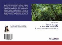
This study identified spatial patterns of forest change in Hoa Binh, Vietnam from 2005 to 2017 based on Remote sensing and GIS. A MLR model was adapted to analyse drivers of three types of forest change, including (i) deforestation and forest degradation, (ii) forest regrowth and (iii) plantation expansion. The results reveal that accessibility and local economic development were determinants of forest cover dynamics during the integration and globalization period and that increased population pressure and poverty were no longer the main factors in forest cover transition. Several key policies in this time period positively affected forest cover change, triggering private sector participation in developing the forest economy by including households and small and medium enterprises in particular. The findings of this study can provide learning points for the implementation of sustainable forest management policies in other Vietnamese provinces or in neighbouring countries. This research has provided an effective tool for visualizing human-forest ecosystem interaction.
Bitte wählen Sie Ihr Anliegen aus.
Rechnungen
Retourenschein anfordern
Bestellstatus
Storno

