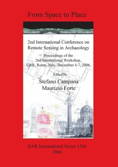
Proceedings of the 2nd International Workshop, CNR, Rome, Italy, December 4-7, 2006 In 2001, UNESCO and the European Space Agency (ESA) launched the 'Open Initiative on the Use of Space Technologies to Monitor Natural and Cultural Heritage of UNESCO Sites'. The 'Open Initiative' is a framework of cooperation to assist countries to improve the observation, monitoring and management of natural and cultural sites as well as of their surroundings, through space technologies. In this field of operations a group of experts, called International Working Group of Space Technologies for World Heritage, was created under the coordination of UNESCO, the present membership including representatives of CNR-ITABC (Italy), GORS (Syria), the Chinese Academy of Sciences (China), NASA (US), ETH (Switzerland) and other European research centres and institutions. At the Beijing conference the topics discussed demonstrated clearly that the concept of Remote Sensing was significantly wider than in the past and involved the integration of numerous different technologies and fields of application: photogrammetry, air photography, air-photo mapping, airborne multi-spectral and thermal imagery, satellite imagery, geophysics, GIS but also, laser scanning, visualization displays, space models virtual reality. This conference at Rome in December 2006, building on these ideas, will aim to continue in this direction, promoting the use of integrated methodologies in remote sensing archaeology so as to help in the creation of new and sustainable policies in the monitoring, interpretation, fruition and communication of the cultural heritage. Including 67 papers from 10 sessions: SESSION 1: Satellite Remote Sensing Archaeology; SESSION 2: Aerial Archaeology: vertical ans oblique photography; SESSION 3: Aerial Archaeology: airborne scanning; SESSION 4: Ground-Based RemoteSensing Archaeology; SESSION 5: Integrated Technologies for Remote Sensing in Archaeology; SESSION 6: Interpreting Landscapes and Settlement Pattern Reconstruction; SESSION 7: Environment Analysis for Remote Sensing Archaeology; SESSION 8: 3D Visualization of Place and Landscapes; SESSION 9: Virtual Archaeological Reconstruction; SESSION 10: Landscapes, CRM and Ethics: POSTER SESSIONS.
Hinweis: Dieser Artikel kann nur an eine deutsche Lieferadresse ausgeliefert werden.
Hinweis: Dieser Artikel kann nur an eine deutsche Lieferadresse ausgeliefert werden.

