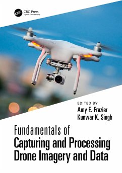
Fundamentals of Capturing and Processing Drone Imagery and Data
Herausgeber: Frazier, Amy; Singh, Kunwar
Fundamentals of Capturing and Processing Drone Imagery and Data
Herausgeber: Frazier, Amy; Singh, Kunwar
- Broschiertes Buch
- Merkliste
- Auf die Merkliste
- Bewerten Bewerten
- Teilen
- Produkt teilen
- Produkterinnerung
- Produkterinnerung
A comprehensive, introductory text on how to use unmanned aircraft systems for data capture and analysis. It provides best practices for executing data capture UAS missions and hands-on learning modules geared toward UAS data collection, processing, and applications. Applications range from Forestry to Urban Landscapes, and other land-use studies.
Andere Kunden interessierten sich auch für
![Fundamentals of Capturing and Processing Drone Imagery and Data Fundamentals of Capturing and Processing Drone Imagery and Data]() Fundamentals of Capturing and Processing Drone Imagery and Data166,99 €
Fundamentals of Capturing and Processing Drone Imagery and Data166,99 €![Remote Sensing and Digital Image Processing with R Remote Sensing and Digital Image Processing with R]() Marcelo de Carvalho Alves (Brazil Federal University of Lavras)Remote Sensing and Digital Image Processing with R156,99 €
Marcelo de Carvalho Alves (Brazil Federal University of Lavras)Remote Sensing and Digital Image Processing with R156,99 €![Imaging from Spaceborne and Airborne Sars, Calibration, and Applications Imaging from Spaceborne and Airborne Sars, Calibration, and Applications]() Masanobu ShimadaImaging from Spaceborne and Airborne Sars, Calibration, and Applications63,99 €
Masanobu ShimadaImaging from Spaceborne and Airborne Sars, Calibration, and Applications63,99 €![Image Analysis, Classification and Change Detection in Remote Sensing Image Analysis, Classification and Change Detection in Remote Sensing]() Morton John Canty (Germany Juelich Research Center)Image Analysis, Classification and Change Detection in Remote Sensing68,99 €
Morton John Canty (Germany Juelich Research Center)Image Analysis, Classification and Change Detection in Remote Sensing68,99 €![Hyperspectral Remote Sensing Hyperspectral Remote Sensing]() Marcus BorengasserHyperspectral Remote Sensing79,99 €
Marcus BorengasserHyperspectral Remote Sensing79,99 €![Thematic Cartography and Geovisualization Thematic Cartography and Geovisualization]() Terry A. Slocum (USA University of Kansas)Thematic Cartography and Geovisualization195,99 €
Terry A. Slocum (USA University of Kansas)Thematic Cartography and Geovisualization195,99 €![Fundamentals of Satellite Remote Sensing Fundamentals of Satellite Remote Sensing]() Emilio Chuvieco (Universidad de Alcala, Alcala de Henares, Spain)Fundamentals of Satellite Remote Sensing71,99 €
Emilio Chuvieco (Universidad de Alcala, Alcala de Henares, Spain)Fundamentals of Satellite Remote Sensing71,99 €-
-
-
A comprehensive, introductory text on how to use unmanned aircraft systems for data capture and analysis. It provides best practices for executing data capture UAS missions and hands-on learning modules geared toward UAS data collection, processing, and applications. Applications range from Forestry to Urban Landscapes, and other land-use studies.
Produktdetails
- Produktdetails
- Verlag: Taylor & Francis Ltd
- Seitenzahl: 386
- Erscheinungstermin: 25. September 2023
- Englisch
- Abmessung: 246mm x 174mm x 20mm
- Gewicht: 762g
- ISBN-13: 9781032022499
- ISBN-10: 1032022493
- Artikelnr.: 68715579
- Herstellerkennzeichnung
- Libri GmbH
- Europaallee 1
- 36244 Bad Hersfeld
- gpsr@libri.de
Amy E. Frazier is an Assistant Professor in the School of Geographical Sciences and Urban Planning at Arizona State University. She has over 10 years of experience in remote sensing data acquisition, processing, and analysis and has been working with UAS for the past 5 years. She holds her FAA Part 107 UAS Pilot's license and has experience with both fixed wing and rotor aircraft. Most recently, she has been part of a multi-institutional team funded by the U.S. National Science Foundation that are developing systems and integrated sensors onboard UAS to better understand severe weather from formation through damage assessment. Kunwar K. Singh is a Geospatial Scientist at AidData research lab and an Affiliate Faculty in the Center for Geospatial Analysis at the College of William & Mary. He has extensive experience in remote sensing data acquisition, processing, and analysis, including the application of LiDAR (light detection and ranging) and UAS to measure, map, and model landscape characteristics and resources. His research focuses on land and vegetation dynamics and their impacts on natural resources.
Part I: Getting Started with Drone Imagery and Data 1. Introduction to
Capturing and Processing Drone Imagery and Data 2. An Introduction to Drone
Remote Sensing and Photogrammetry 3. Choosing a Sensor for UAS Imagery
Collection 4. Mission Planning for Capturing UAS Imagery 5. Drone
Regulations: What You Need to Know before You Fly 6. Structure from Motion
(SfM) Workflow for Processing Drone Imagery 7. Aerial Cinematography with
UAS Part II: Hands-On Applications Using Drone Imagery and Data 8. Planning
Unoccupied Aircraft Systems (UAS) Missions 9. Aligning and Stitching
Drone-Captured Images 10. Counting Wildlife from Drone-Captured Imagery
Using Visual and Semi-Automated Techniques 11. Terrain and Surface Modeling
of Vegetation Height Using Simple Linear Regression 12. Assessing the
Accuracy of Digital Surface Models of an Earthen Dam Derived from SfM
Techniques 13. Estimating Forage Mass from Unmanned Aircraft Systems in
Rangelands 14. Applications of UAS-Derived Terrain Data for Hydrology and
Flood Hazard Modeling 15. Comparing UAS and Terrestrial Laser Scanning
Methods for Change Detection in Coastal Landscapes 16. Digital Preservation
of Historical Heritage Using 3D Models and Augmented Reality 17.
Identifying Burial Mounds and Enclosures Using RGB and Multispectral
Indices Derived from UAS Imagery 18. Detecting Scales of Drone-Based
Atmospheric Measurements Using Semivariograms 19. Assessing the Greenhouse
Gas Carbon Dioxide in the Atmospheric Boundary Layer

