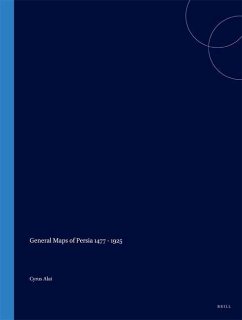
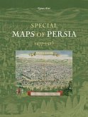
Iran, or Persia as it was known in the West for most of its long history, has been mapped extensively for centuries but the absence of a good cartobibliography has often deterred scholars of its history and geography from making use of the many detailed maps that were produced. This is now available, prepared by Cyrus Alai who embarked on a lengthy investigation into the old maps of Persia, and visited major map collections and libraries in many countries.
With over four hundred separate map entries and over two hundred illustrations this work covers all the important printed general maps of Persia from the early editions of Ptolemy at the end of the 15th century until 1925 when the Qajar dynasty was overthrown. Useful historical accounts provide the background to this wealth of cartographic achievement. After a description of the many editions of Ptolemy, later maps are divided into groups according to the country where they were produced: Italy, the Low Countries, France, Germany, Great Britain, Russia, America, Persia, Turkey, and Spain with Portugal. This permits the work of a single cartographer to be handled in an uninterrupted sequence, thus aiding quick reference to a particular style of map, and its later offshoots.
At the end of each major entry, further details concerning different editions and variations, other related maps, historical notes and unique or important features are provided, thus fitting the map into its chronological background. The large number of indexes at the end of the book should enable map collectors, dealers and librarians to identify any map of Persia with ease.
This book is a good balance between history and geography, and will appeal to a wide range of readers. Many Persian maps have surely been rescued from obscurity, and it is now possible to study sequence of developing geographical knowledge over a historically and economically important part of Asia. It is unlikely to be superseded for a very long time.
This second, revised edition includes two new maps and a list of addenda.
Hinweis: Dieser Artikel kann nur an eine deutsche Lieferadresse ausgeliefert werden.
''It is most informative and clearly set out and looks lovely too - it seems destined for the scholar's library, the collector's bookshelf and the amateur's coffee table: a very rare achievement.'. Mr. Peter Barber, the Head of the Map Library/British Library
Whether you are an interested amateur, a cartographic historian or a librarian, you can be assured that will have seen nothing like this book before' Tony Campbell on MapHist diiscussion group.
'This outstanding book is a welcome addition to the histories of cartography. Its scholarship is frist rate, its graphic reproduction is excellent, and its physical properties will sustain it under heavy use as a library reference. Peter Barber head of the Map Library, the British Library, stated: "It is most informative and clearly set out and looks lovely too - it seems destined for the scholar's library, the collector's bookshelf, and the amateur's coffee table: a very rare achievement."...In both content and construction, this is a work that will last for decades'
Hubert O. Johnson, The Portolan, 2006.
'All in all no question remains unanswered in this volume. Thanks to the publisher, the maps have been printed in such quality and size that the texts are legible.....
Uta Lindgren, Cartographica Helvetica, January 2007.
Cyrus Alai has produced an outstanding book of the Maps of Persia. In these days it is easy to forget the once mighty Empire that contested the Greeks and preceded the Romans. It holds great historical interest but of more contemporary importance is the fact that it does help us appreciate the central Geo-Political situation of Iran today and our need to both understand what it is about and relate to it.
Lord Peter Temple-MorrisThis publication's major contribution is bringing into one volume a rich and wide range of bibliographic material, thereby providing an invaluable resource for further investigation for those interested in the region. L. Yacher, CHOICE2006
"The care and effort used for identifying these maps, and the related historical, geographical, linguistic and, when applicable, archaeological information, contained in the two volumes, have made them a necessary tool for any historical, geographical and some other scientific, research works in the field of Iranian Studies. [...] Producing and publishing of these volumes have been a unique and major scientific event which can hardly be described in words. One should see them to appreciate their high value and importance."
Prof. Dr. Ehsan Yarshater in Iran-Nameh. A Persian quarterly of Iranian Studies 26.3-4 (2011), pp. 224-231.

