29,99 €
inkl. MwSt.
Versandkostenfrei*
Versandfertig in 1-2 Wochen
payback
15 °P sammeln
  • Broschiertes Buch

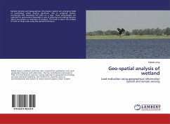
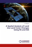
Remote Sensing and Geographical Information System are emerging fields of technology which playing significant role in analytical studies, monitoring and visualizing the data on a map. These technologies are essential for government especially in case of planning and making decision about any project or extension of projects. This book is about the analysis of land on large scale using Geo-spatial techniques.

Produktbeschreibung
Remote Sensing and Geographical Information System are emerging fields of technology which playing significant role in analytical studies, monitoring and visualizing the data on a map. These technologies are essential for government especially in case of planning and making decision about any project or extension of projects. This book is about the analysis of land on large scale using Geo-spatial techniques.
Hinweis: Dieser Artikel kann nur an eine deutsche Lieferadresse ausgeliefert werden.
Autorenporträt
Rabail Urooj é bolseira de doutoramento. Concluiu o seu mestrado em ciências ambientais com distinção e mais um mestrado com distinção no domínio da gestão e política ambientais. Atualmente, trabalha como Professora Assistente. É autora de vários artigos de investigação e capítulos de livros.