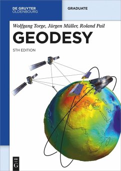
The fifth edition of this textbook has been completely revised and significantly extended in order to reflect the revolution of geodetic technologies, methods and applications during the last decade. The Global Geodetic Observing System established by the IAG utilizes a variety of techniques to determine the geometric shape of the earth and its kinematics, the variations of earth rotation, and the earth's gravity field. The societal importance of geodetic products was highlighted by the UN resolution on the Global Geodetic Reference Frame. In this context, both space and terrestrial techniques play a fundamental role. Recent space missions are monitoring climate-relevant processes such as mass transport in the Earth system and sea level changes. The analysis of the time variation of the geodetic products provides the link to neighboring geosciences and contributes to proper modelling of geodynamic processes. New satellite mission concepts and novel technologies such as quantum gravimetry and optical clocks show great potential to further improve the geodetic observing system in the future. The book especially addresses graduate students in the fields of geodesy, geophysics, surveying engineering, geomatics, and space navigation. It should also serve as a reference for geoscientists and engineers facing geodetic problems in their professional work. The book follows the principal directions of geodesy, providing the theoretical background as well as the principles of measurement and evaluation methods, which is enriched with numerous figures. An extensive reference list supports further studies.
Hinweis: Dieser Artikel kann nur an eine deutsche Lieferadresse ausgeliefert werden.
Hinweis: Dieser Artikel kann nur an eine deutsche Lieferadresse ausgeliefert werden.
"Aufgrund der umfassenden Darstellung der Geodäsie, von ihren historischen Wurzeln bis hin zu den neuesten Entwicklungen und Anwendungen, bietet 'Geodesy' einen unvergleichlichen Überblick über dieses wichtige und sich ständig weiterentwickelnde wissenschaftliche Feld. Damit eignet es sich sowohl als grundlegendes Handbuch für fortgeschrittene Studierende der Geodäsie als auch als Referenz für Wissenschaftler und Ingenieure auch aus benachbarten Fachdisziplinen." Dr. Rainer Fletling, Universität Kassel, Fachbereich Bauingenieur- und Umweltingenieurwesen
4. Edition
"The book is thoroughly revised and extended with the important results achieved in the years since the last edition (2001). The section on Satellite Observations has been extended with descriptions of the current missions like GRACE and GOCE. Geodynamics is well treated in an extended chapter on "Structure and Dynamics of the Earth". The book contains an extensive bibliography with 500 references added since the edition of 2001. [..] But what is extremely important is the index, which makes the book useful as a handbook for everyone. The book also includes many fine figures and illustrations, now also in color. [..] It is a wonderful book with so much important information covering all of modern geodesy." Carl Christian Tscherning in: Journal of Geodesy, 86, p.786 (2012)
"There is sufficient new material in this edition to prompt anyone seriously interested in the subject to consider purchasing it." -- L. M. Sebert in: Geomatica 1/2002
"Dieses Buch wird allen Geodäsie-Studenten und den Berufskollegen, die mit geodätischen Fragestellungen konfrontiert werden, zur Anschaffung wärmstens empfohlen." -- B. Witte in: Flächenmanagement und Bodenordnung
"Es ist das bisher einzige Textbuch mit einem aktuellen Überblick über die Geometrische und Physikalische Geodäsie, über geodätische Referenzsysteme und über die zeitabhängigen geodätischen Konzeptionen im Zeitalter der geodätischen 'NanoScience'. Der Autor ist zum neuesten Werk zu beglückwünschen: Möge eine weitere Verbreitung ein minimaler Dank für die jahrzehntelange harte Arbeit am neuen Text sein. Als Leitfaden für die eigene Arbeit benötigt jeder Geodät und Geoinformatiker dieses hoch willkommene Textbuch." -- E. W. Grafarend in: Zeitschrift für Vermessungswesen 6/2001
"Deshalb können wir das Buch als Lehr- und Handbuch für Studenten, Hochschullehrer, wissenschaftliche Mitarbeiter, Promovierende, sogar Diplomingenieure in der Praxis, für jede, die in einem einzigen Band ein klares Bild über die gesamte (höhere) Geodäsie und ihrer Lage in dem Prozess des naturwissenschaflichen Erkennens der Erde bekommen möchten wohl begründet empfehlen." -- Peter Biró in: Allgemeine Vermessungsnachrichten 1/2006

