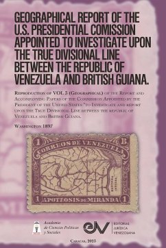
Venezuela's protests against the invasions of the territory of Guayna Esequiba by the British Guiana authorities, which had increased since 1841, led the national government in 1876 to request assistance from the United States, invoking the Monroe Doctrine, in order to force the United Kingdom to resolve the boundary dispute that existed over the Essequibo Territory through international arbitration. After nearly two decades, in 1895, it was the newly appointed U.S. Secretary of State, Richard Olney, who took the matter as the government's own and sent a strong note to the British Prime Minister and Foreign Secretary Lord Salisbury, demanding that the British submit the border dispute to arbitration. In response to Salisbury's reply that the Monroe Doctrine had no validity as international law, which the U.S. government considered unacceptable, in December 1895, President Grover Cleveland expressly invoked such Doctrine, requesting authorization from Congress to appoint a Boundary Commission, proposing that the commission's findings be applied "by all means," proposal that was approved by Congress. Thus, in 1896 the "Commission appointed by the President of the United States" to investigate and report on the true dividing line between the Republic of Venezuela and British Guiana. The work of the U.S. Presidential Commission was exhaustive and complete, published in several volumes, where through the analysis of all existing historical and cartographic information, the boundary between Venezuela and British Guiana was clearly studied. Volume 3 (Geographical) of the Report of the Commission is reproduced here, containing the Reports of Severo Mallet Prevost (On the Cartographic Testimony of Geographers), Justin Windsor (on the Maps of the Orinoco-Essequibo Region), George Lincoln Burr (on the Maps of Official Sources), George Lincoln Burr (on the Historical Maps), Marcus Baker (on the Geography of the Orinoco-Esequiba Region) and Marcus Baker (on the Partial List of Maps). of the Orinoco Essequibo Region).
Hinweis: Dieser Artikel kann nur an eine deutsche Lieferadresse ausgeliefert werden.
Hinweis: Dieser Artikel kann nur an eine deutsche Lieferadresse ausgeliefert werden.

