Geoinformatics
Cyberinfrastructure for the Solid Earth Sciences
Herausgeber: Keller, G Randy; Baru, Chaitanya
Geoinformatics
Cyberinfrastructure for the Solid Earth Sciences
Herausgeber: Keller, G Randy; Baru, Chaitanya
- Gebundenes Buch
- Merkliste
- Auf die Merkliste
- Bewerten Bewerten
- Teilen
- Produkt teilen
- Produkterinnerung
- Produkterinnerung
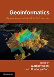
Presents case studies from across the geosciences to provide a fascinating and accessible introduction to this emerging field.
Andere Kunden interessierten sich auch für
![Applying Geoinformatics Science to locate Vulnerable Communities Applying Geoinformatics Science to locate Vulnerable Communities]() Harold Osmond WallApplying Geoinformatics Science to locate Vulnerable Communities50,99 €
Harold Osmond WallApplying Geoinformatics Science to locate Vulnerable Communities50,99 €![Geoinformatics in Applied Geomorphology Geoinformatics in Applied Geomorphology]() Geoinformatics in Applied Geomorphology256,99 €
Geoinformatics in Applied Geomorphology256,99 €![Satellite Remote Sensing for Earth and Space Science Satellite Remote Sensing for Earth and Space Science]() Mukesh Singh BooriSatellite Remote Sensing for Earth and Space Science64,99 €
Mukesh Singh BooriSatellite Remote Sensing for Earth and Space Science64,99 €![Introduction to the Biogeochemistry of Soils Introduction to the Biogeochemistry of Soils]() Ronald AmundsonIntroduction to the Biogeochemistry of Soils43,99 €
Ronald AmundsonIntroduction to the Biogeochemistry of Soils43,99 €![Aquatic Organic Matter Fluorescence Aquatic Organic Matter Fluorescence]() Aquatic Organic Matter Fluorescence152,99 €
Aquatic Organic Matter Fluorescence152,99 €![The Joy of Science The Joy of Science]() Roel SniederThe Joy of Science95,99 €
Roel SniederThe Joy of Science95,99 €![Extreme Natural Hazards, Disaster Risks and Societal Implications Extreme Natural Hazards, Disaster Risks and Societal Implications]() Extreme Natural Hazards, Disaster Risks and Societal Implications114,99 €
Extreme Natural Hazards, Disaster Risks and Societal Implications114,99 €-
-
-
Presents case studies from across the geosciences to provide a fascinating and accessible introduction to this emerging field.
Hinweis: Dieser Artikel kann nur an eine deutsche Lieferadresse ausgeliefert werden.
Hinweis: Dieser Artikel kann nur an eine deutsche Lieferadresse ausgeliefert werden.
Produktdetails
- Produktdetails
- Verlag: Cambridge University Press
- Seitenzahl: 388
- Erscheinungstermin: 30. Juni 2011
- Englisch
- Abmessung: 249mm x 180mm x 23mm
- Gewicht: 975g
- ISBN-13: 9780521897150
- ISBN-10: 0521897157
- Artikelnr.: 32560452
- Herstellerkennzeichnung
- Libri GmbH
- Europaallee 1
- 36244 Bad Hersfeld
- gpsr@libri.de
List of contributors; Preface; Introduction: 1. Science needs and
challenges for geoinformatics G. Randy Keller; 2. Introduction to IT
concepts and challenges Chaitanya Baru; Part I. Case Studies from Other
Disciplines: 3. Semantic cyberinfrastructure: the virtual solar-terrestrial
observatory Peter Fox and Deborah L. McGuinness; 4. Cyberinfrastructures
for life sciences and biomedicine Sriram Krishnan and Ravi Madduri; Part
II. Modeling Software and Community Codes: 5. Development, verification and
maintenance of computational software in geodynamics Michael Gurnis, Walter
Landry, Eh Tan, Luis Armendariz, Leif Strand and Michael Aivazis; 6.
Parallel finite element modeling of multi-timescale faulting and
lithospheric deformation in the western US Mian Liu, Youqing Yang, Qingsong
Li, Gang Luo and Huai Zhang; 7. Next-generation plate-tectonic
reconstructions using GPlates James A. Boyden, R. Dietmar Müller, Michael
Gurnis, Trond H. Torsvik, James A. Clark, Mark Turner, Hamish Ivey-Law,
Robin J. Watson and John S. Cannon; Part III. Visualization and Data
Representation: 8. Visualization of seismic model data Amit Chourasia; 9.
The UNAVCO GEON Integrated Data Viewer for exploration, analysis, and
integration of geoscience data Stuart Wier and Charles Meertens; Part IV.
Knowledge Management and Data Integration: 10. Data and tools for geologic
timelines and timescales Peter Sadler and Cinzia Cervato; 11. Modeling
geodynamic processes with ontologies Hassan Babaie; Part V. Web Services
and Scientific Workflows: 12. Service orientation in the design of a
community hydrologic information system Ilya Zaslavsky and David Maidment;
13. Web services for seismic data archives Robert Casey and Timothy Ahern;
14. Development of robust data system for gravity and magnetic anomaly
data: a case study of a community-based effort for point data Raed Aldouri
and G. Randy Keller; 15. Scientific workflows for the geosciences: an
emerging approach to building integrated data analysis systems Ilkay
Altintas, Daniel Crawl and Christopher Crosby; 16. Online access and
processing of Lidar topography data Christopher Crosby, J. Ramon
Arrowsmith, Viswanath Nandigam and Chaitanya Baru; 17. Use of abstraction
to support geoscientists' understanding and production of scientific
artifacts Ann Gates, Paulo Pinheiro da Silva, Leonardo Salayandia, Omar
Ochoa, Aida Gandara and Nicholas Del Rio; Part VI. Emerging International
and Other Efforts: 18. It's not your data, it's everyone's: the benefits of
a corporate approach to scientific information Ian Jackson and Richard
Hughes; 19. TOPO-EUROPE and cyberinfrastructure: quantifying coupled deep
earth-surface processes in 4D Sierd Cloetingh and H. P. Bunge; 20.
OneGeology - from concept to global project Ian Jackson; 21. Geoinformatics
developments in Germany Jens Klump, Joachim Wächter, Peter Löwe, Ralf Bill
and Matthias Lendholt; 22. iGEON: networking the Indian geosciences
community through GEON K. V. Subbarao, Arun Agarwal, Rajeev Wankar and
Chaitanya Baru; 23. Geoinformatics in the public service: building a
cyberinfrastructure across the geological surveys M. Lee Allison, Linda C.
Gundersen and Stephen M. Richard; 24. Application of the U.S. geoscience
information network to deploying a national geothermal data system Stephen
M. Richard, Ryan Clark and Wolfgang Grunberg; Index.

