53,99 €
inkl. MwSt.
Versandkostenfrei*
Versandfertig in 6-10 Tagen
  • Broschiertes Buch

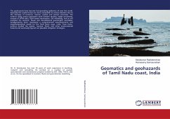
The geohazards have become fast-spreading epidemics all over the world. Especially the coastal zones are more susceptible to various disasters due to the interplay of tectonics, riverine, coastal and aeolian processes. The authors using various geomatics tools (remote sensing, image processing, analysis of SRTM data, DEM based visualization, GIS modelling, and so on) analyzed the tectonic, fluvial and denudational geomorphic anomalies. Amalgamating them, developed a comprehensive morphotectonic and morphodynamical model for the Tamil Nadu coast, India. From there, authors studied the seismic,…mehr

Produktbeschreibung
The geohazards have become fast-spreading epidemics all over the world. Especially the coastal zones are more susceptible to various disasters due to the interplay of tectonics, riverine, coastal and aeolian processes. The authors using various geomatics tools (remote sensing, image processing, analysis of SRTM data, DEM based visualization, GIS modelling, and so on) analyzed the tectonic, fluvial and denudational geomorphic anomalies. Amalgamating them, developed a comprehensive morphotectonic and morphodynamical model for the Tamil Nadu coast, India. From there, authors studied the seismic, tsunami, flood, and other environmental hazards and eventually figured out plausible mitigation strategies.
Autorenporträt
Dr. R. Selvakumar has over 25 years of work experience in teaching, research and consulting. He worked on a number of coastal, groundwater and neotectonics projects funded by DST, ISRO, TNSTC and so on. He has specialized in tsunami, flood and groundwater modelling.